Ascending the Zugspitze in November 2022
In early November, I went on vacation to the Alps and wanted to try to ascend the Zugspitze over a via ferrata called Stopselzieher (German Wikipedia article; Route on OpenStreetMap). After the first day of hiking along the high-altitude trail (“Höhenweg”) at the Eibsee, I ascended the Zugspitze on November 9th
… at least almost, but more about that below.
Info & safety advice
Preparation
I booked my vacation about two weeks in advance and followed the webcam of the Zugspitze, as well as the weather report almost daily.
In addition, I studied maps, went through routes, read other trip reports, and watched YouTube videos on the Stopselzieher route.
Also, I looked up the opening hours of the railroads and didn’t see until after I booked my vacation that the railroad and all cable cars were out of service. So I couldn’t go back down with either the cogwheel or the cable car.
During this revision period, there is only the Eibsee bus (timetable, fares), which you can use for free with the Grainau-GuestCard (“Grainau-GästeKarte”), which I got at the hotel during check-in.
Route planning
The closed trains, of course, greatly impacted my route planning. Here are the routes I looked at:
- Rund trip Eibsee: From the Eibsee over the Stopselzieher to the Zugspitze and back. Length of about 18 km, plus 2 km ascent and descent.
- Eibsee → Zugspitze → Ehrwald (or the other way around): Alternatively to the first route, you can also descend to Ehrwald (or ascent from Ehrwald and descent to Eibsee). Shortens the route by about 1.5 km to 16.5 km.
- Höllental → Riffelscharte → Eibsee/Ehrwald: No Zugspitze ascent! From Hammersbach to the Höllentalangerhütte and via the Riffelscharte, then optionally to the Eibsee (a total of about 15 km) or to Ehrwald (a total of about 19 km).
Warning! The complete Höllental area (including Stangensteig) is not passable in winter! Ways are closed and bridges dismantled! - Round trip Ehrwald: From Ehrwald via the Stopselzieher to the Zugspitze and back. Length of about 16 km, plus 2 km ascent and descent.
I decided to Route 4, because it is the shortest and the beginning is on the west / south side. There I hoped for a snow and ice-free beginning (which was the case).
Show complete mapWeather
I followed the weather report about daily for the two weeks before the tour. Fortunately, for my vacation days, pleasant weather was predicted well in advance. However, the weekend before the tour (i.e. 3-4 days before), it snowed properly (about 20 cm of fresh snow), as announced in the weather report.
However, on the webcam of the Zugspitze, one could nicely follow how the snow melted over time, yet lots of snow remained. I also expected slippery paths because the melted snow probably freezes overnight.
If it had snowed again, rained or had a storm been forecast, I would’ve never even attempted the tour!
Equipment
Basically, I had my normal hiking gear for day hikes with me:
- Hiking boots, trekking poles, backpack (daypack 24 L).
- Warm jacket, rain poncho and thick fleece jacket
- Water bottle (1 L) and tasty cheese roll
- Small first aid kit, rescue blanket, whistle, flashlight, pocket knife
Plus the following equipment for via ferrata:
- Helmet
- Climbing harness + via ferrata set
- gloves
This equipment is necessary for the Georg-Jäger-Steig and especially for the Stopselzieher. Some experienced people may do the tour in summer without belaying, but I advise against it!
Safety note
A few words of warning:
- The season: It was winter (early November), so this means the following:
- Revision time: Except for the DB and the Eibseebus, no trains and lifts run to/from the Zugspitze.
- Off-season: Hardly anyone is out there, you are mostly completely alone (it’s lovely but rather unfortunate in an emergency situation).
- Weather: As mentioned above, there is definitely snow and you should be prepared for temperatures below 0° C.
- Via ferrata: Even if the Stopselzieher is classified as easy, K1/K2 or A/B, you should of course know your own limits. The ascend is exhausting and if you feel exhausted already at the Georg-Jäger-Steig, turn back! I would like to mention here the list of deaths on the Zugspitze – 2012 was the last year in which no one died while climbing the Zugspitze!
- Contact Information: Don’t forget to leave your contact information, tour duration and route with hotel/campsite personnel, relatives and friends. Let them know when you have finished your tour.
If you are attempting the Stopselzieher (or any other route) in winter: Familiarize yourself with the idea of aborting the tour and turning back beforehand and plan this into the route. Don’t take unnecessary risks!
Arrival
On Tuesday November 9th 2022, my train left at 06:43 AM from Untergrainau to Ehrwald Zugspitzbahn in Austria.
However, booking the ticket via the DB-App in the morning proved to be more difficult than I thought: The DB-App logged me out, I didn’t have the password in my head, resetting the password only worked the second time, then the DB-App thought my trip was in the past and the app didn’t accept the new password anyway. Great.
Then it worked via the website, but I had already been on the train for a few minutes. The conductor then came around the corner just at the moment when the PDF of the ticket was finally downloading. Oh boy!
Lesson learned: Buy your ticket the day before! In Untergrainau there are – as probably at most stations along the route – no vending machines for tickets.
Gamsalmhütte
I arrived in Ehrwald at 7 AM, it was already light, so I started hiking with the Zugspitze in view, which you can already see from the station.

My route first went towards Gamskar, past lake Gamskar (“Gamskarsee”), the Gamrkar alpine hut (“Gamsalmhütte”) and the Gamskar cable car (“Gamskarlift”). The way to the Gamsalmhütte was already quite exhausting for me, but went quite well and I was there at around 8 AM.
By the way, the hut is closed in November, because the lift is also closed and everything is made ready for the winter. But there were still benches to sit down along with great views.
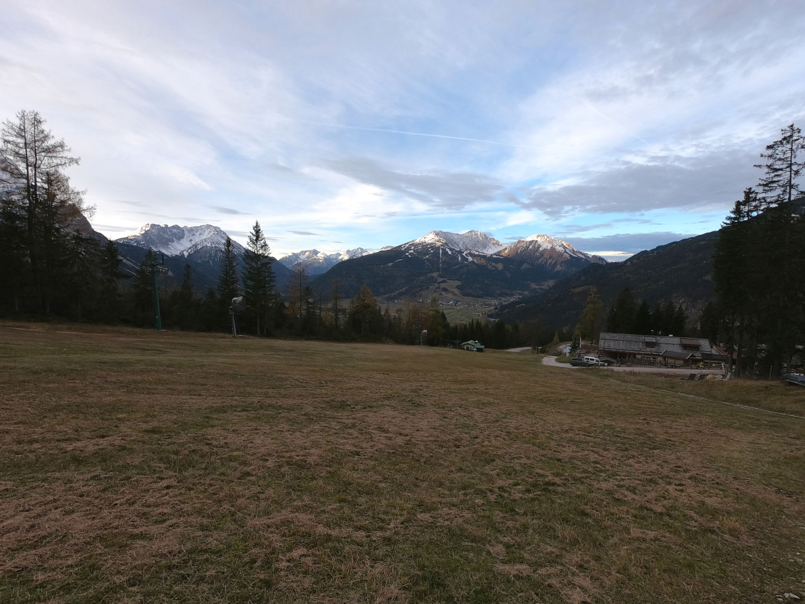
For the 2.7 km / 1.6 mi and 260 m / 850 ft ascend to the hut, I think the one hour was not bad at all. After two tasty cheese rolls, I continued without a jacket, which was too warm for me.
Gamskar & Old middle station
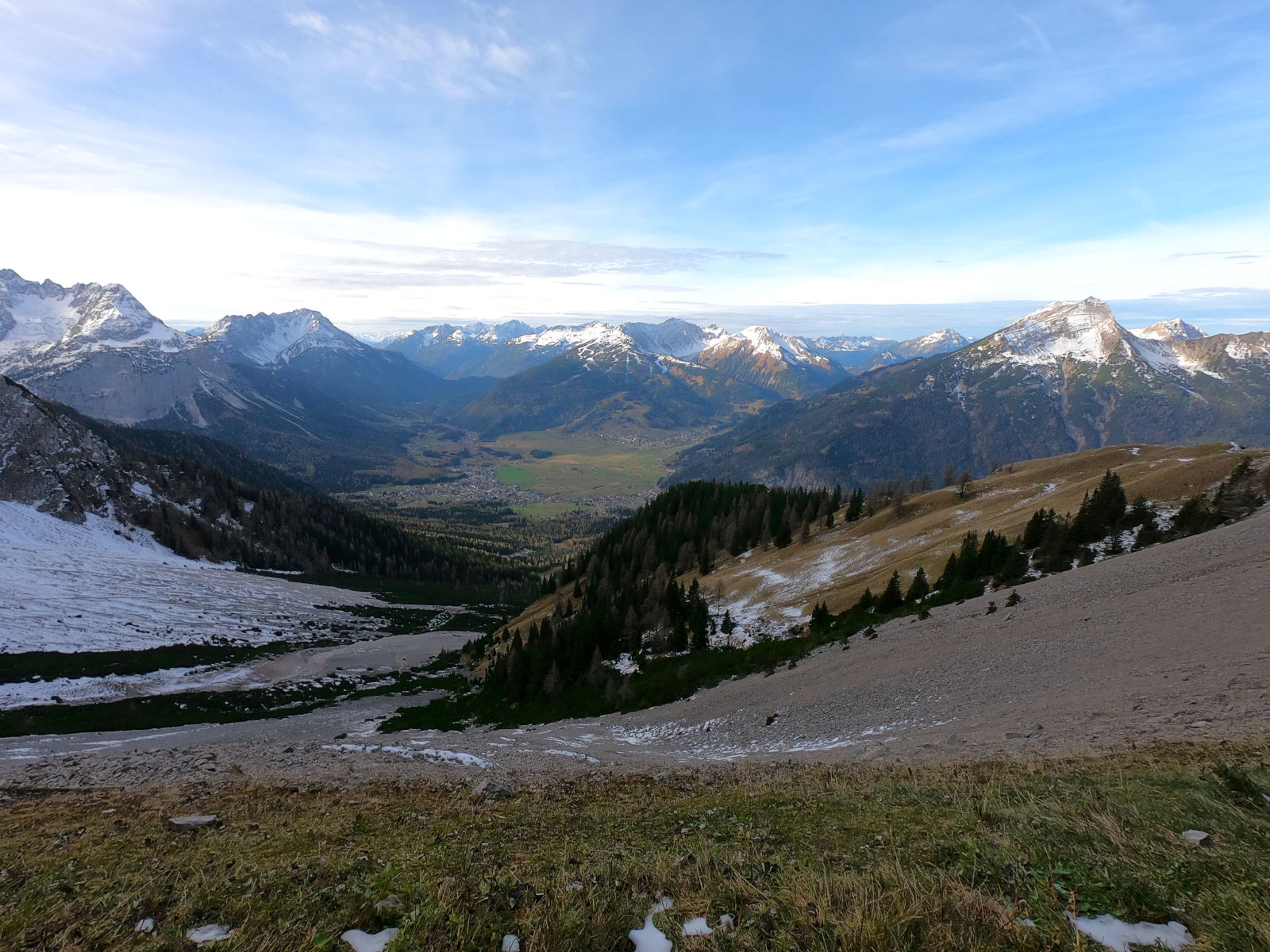
After the hut, there is still a good path for walking, but the slope increases to about 30°, in places more. However, the view gets better and better, which motivated me quite well.
At the end of the Gamskar cable car (Gamskarlift), the path splits and there are several ways to get up, but they all come together again later anyway, so it doesn’t matter which one you choose. Here the Alpine flair slowly begins as the grass of the ski slope ends and gives way to gravel and scree. Between mountain pines, it goes further up and I met the first mountain goats, which were much more nimble than I was.
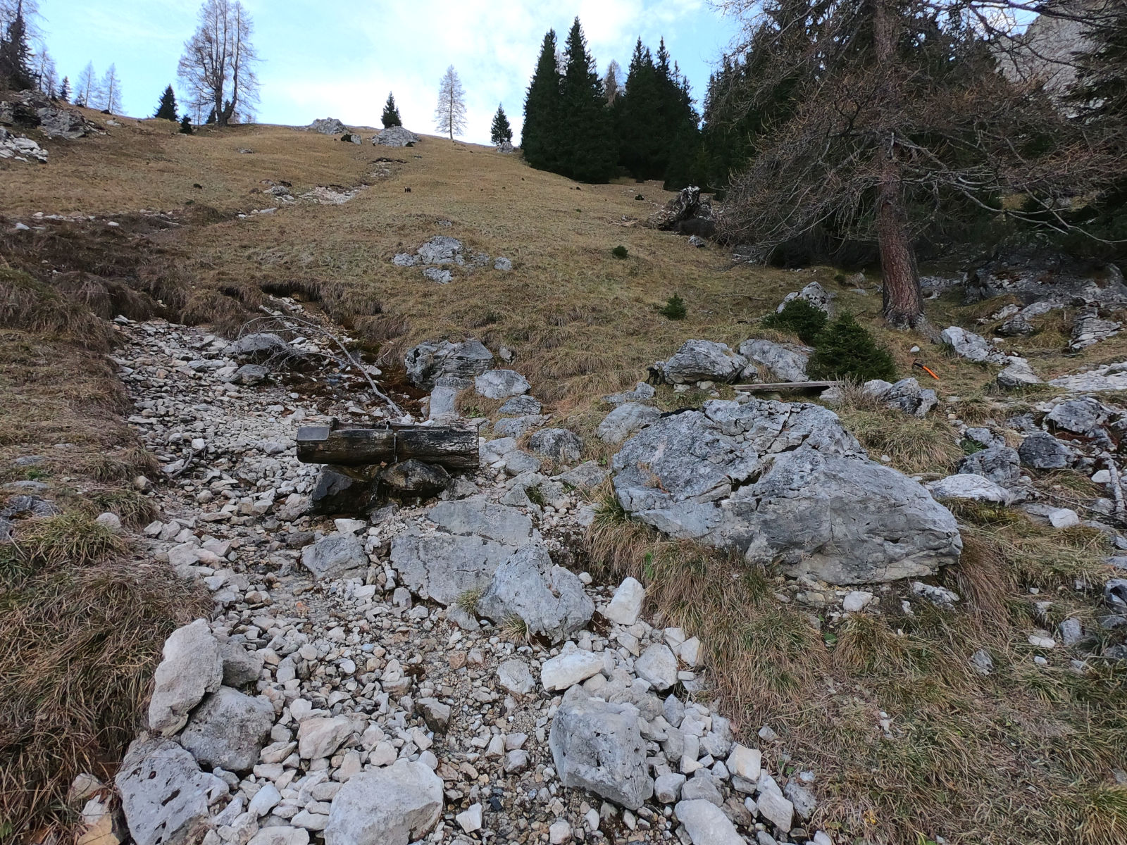
About another 2 km / 1.2 mi and 400 m / 1300 ft of altitude after the Gamsalmhütte I came to the Wiesbrunnen (translates to ***meadow fountain ***), a water fountain with a nice bench to rest on. Of course, it’s worth taking a break here, the view is just awesome! I could also fill my water bottle, which holds a liter, but was already almost empty. After this short break, I went on in a T-shirt, even my sweat jacket was now too warm for me.
After another 500 m / 0.3 mi and 150 m / 500 ft of altitude (at meanwhile 1830 m / 6000 ft above sea level), the vegetation slowly ended and the scree field Gamskar was in front of me. Even here were mountain goats too, whatever they were looking for, but apparently, they still found something tasty between the rocks. At this altitude, there was some snow here and there, but the path itself was free.
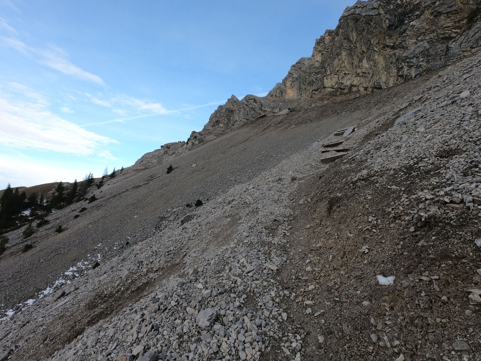
Then, at the height of the old middle station, there is a strip of meadow along with a bench. What a view!
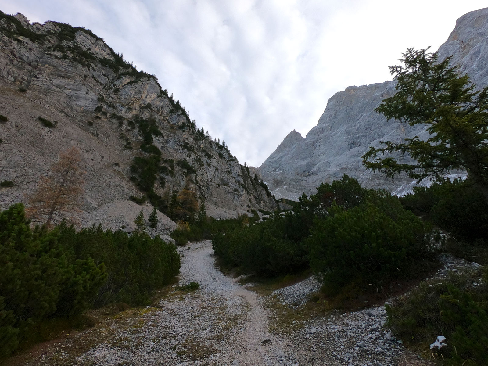
Georg-Jäger-Steig
At least on a winter tour, I recommend to put on the climbing gear at this bench because here begins the via ferrata Georg-Jäger-Steig. There are no climbing protections at this point yet, but there is a risk of rockfall and besides, it’s flat, protected and you have space here. In summer, you may get to the alpine hut Wiener-Neustädter-Hütte without climbing protection, but more about safety below.
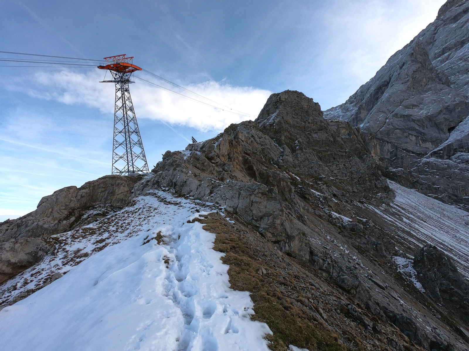
Then the Georg-Jäger-Steig begins, which leads to the alpine hut Wiener-Neustädter-Hütte.
The up trail to the old lift support is still quite walkable. Steep, but here and there steps have been built from wooden boards.
At 1900 m / 6230 ft you then reach a ridge at which also a hiking trail from the direction of Eibsee arrives. From there, I then changed to the north side of the Zugspitze massif, which was covered in partly trampled and somewhat slippery snow and ice, including a decent cold wind. Here you should – at least with the ice and snow – really watch out, there is not yet any safety!
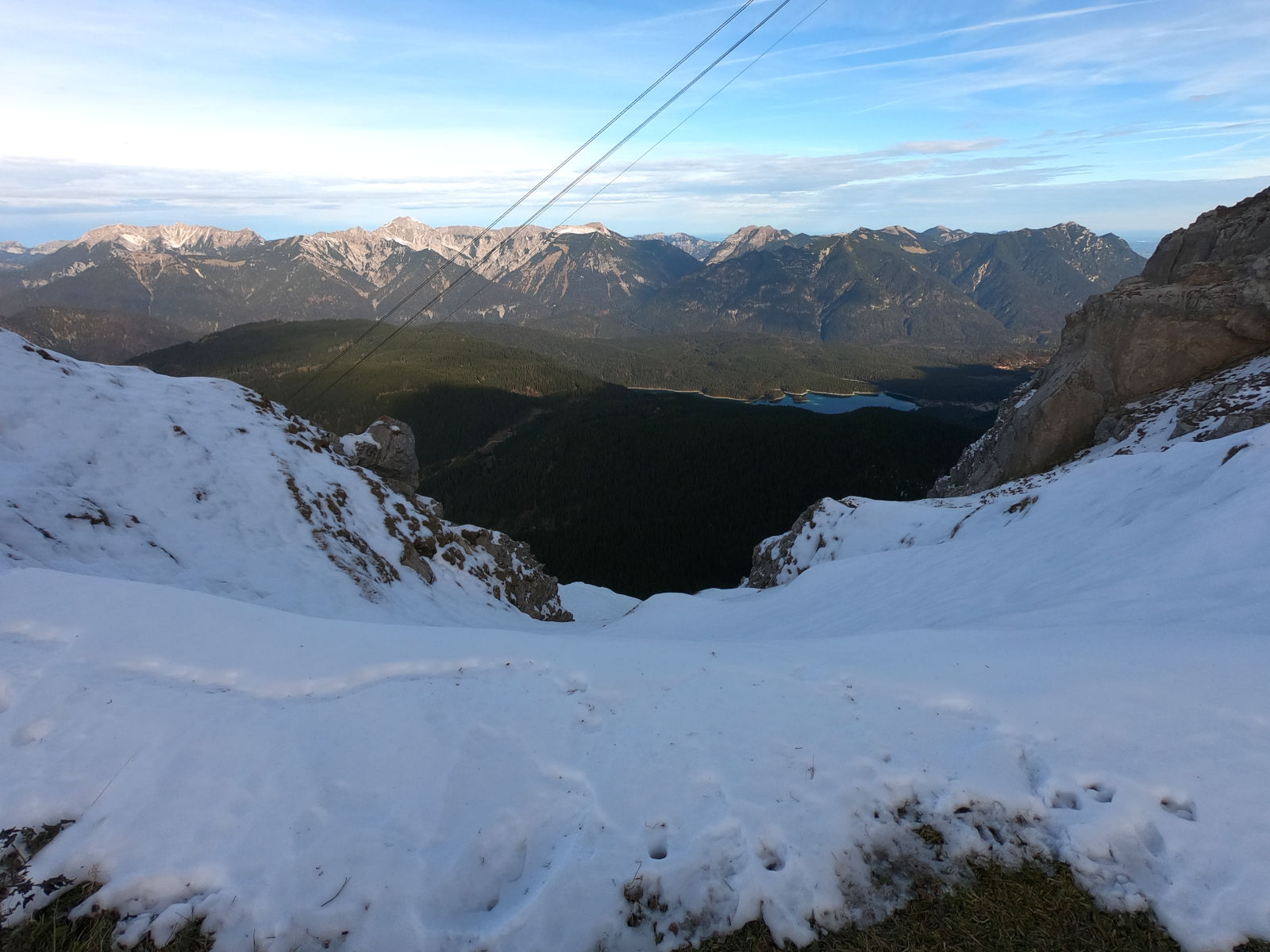
However, shortly after the turnoff towards Eibsee comes the point from which a belay is in place. I was completely on the north side, the snow had turned into ice and, obviously, the whole path was very slippery – the use of the safety is highly recommended!
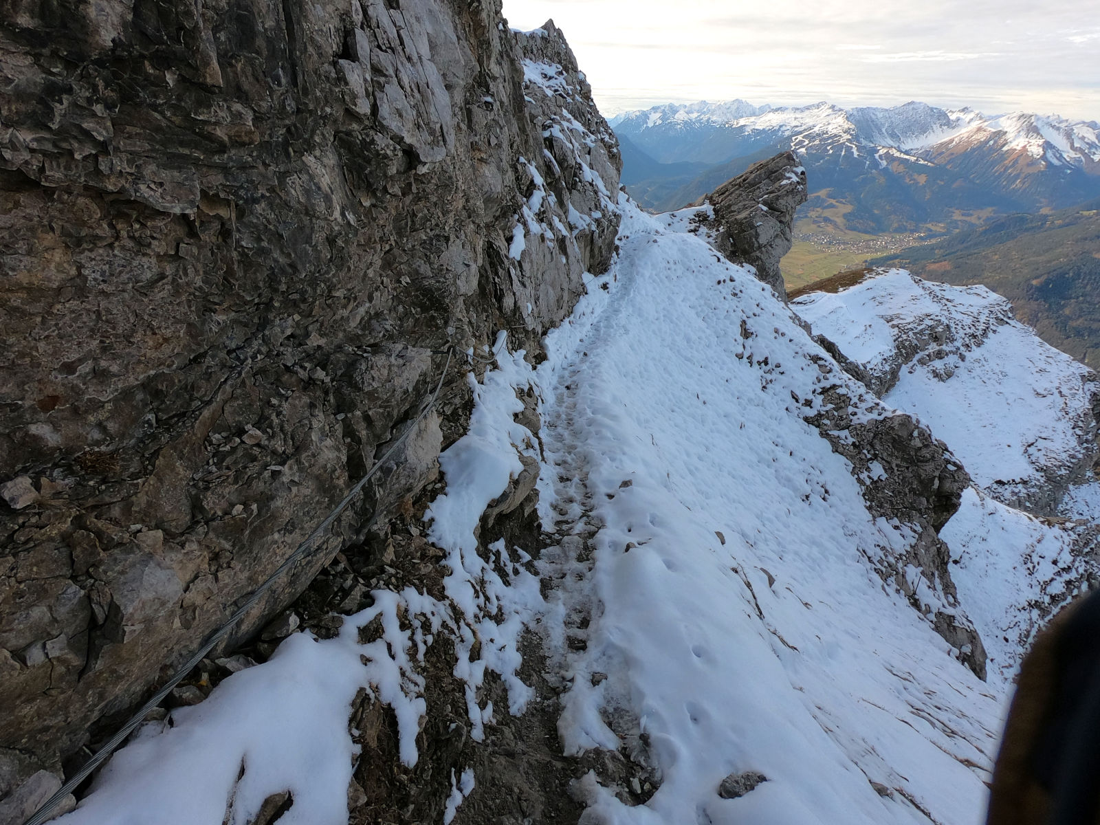
However, the trail itself was easy and the via ferrata feeling began.
Break off
However, at the level of today’s Tiroler Zugspitzbahn, safety ends again, but on one side there is a steep downhill and the path is still slightly icy. Since I had no suitable equipment for slippery and icy terrain with me, it was the end for me here.

You can also see the place in the video mentioned above, but there is significantly less snow.
Up to here, I have covered 5.7 km / 3.5 mi and 1050 m / 3440 ft of altitude and it took me 3:40h. For me, as a flatland hiker from Hamburg (northern Germany), a solid result. However, I also hurried a bit and you should plan for a relaxed hike (especially as a group) quite about 5 hours to the Wiener-Neustädter-Hütte, or trust the times on signposts.
Way back
The way back was on the one hand relaxed (I knew the route now), but on the other hand very exhausting for the knees and legs. On the way I met the first other hiker of the day, who followed the same strategy as me: as far up as possible and return if it goes no further.
At the Gamsalmhütte were then a few more people on the road, but it was generally quite empty.
Conclusion
What can I say, it was a really lovely tour and I’m glad not to have made this in the peak season. I’m also glad about the early termination.
However, if you seriously intend to make the route in winter to the Zugspitze, you definitely need more suitable equipment, everything else is life-threatening!