Rennsteig - Thuringian Forest in April 2022
After a long Corona break and only single-day tours, I finally went on April 21st 2022 to a multi-day tour, this time on the Rennsteig through the Thuringian Forest.
Since I had planned for three nights outdoors, I only brought light luggage with me. Accordingly, the tour was not overly long (66 km / 41 mi), which was not bad due to the last day’s weather. But more about this below.
Route
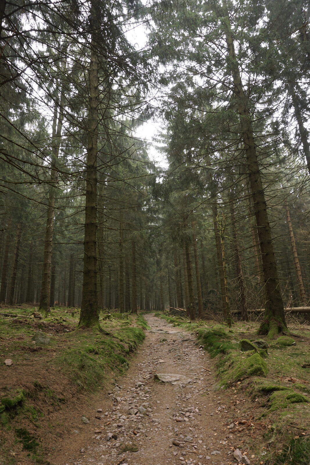
Show complete mapI had chosen the Thuringian Forest because it is one of the few larger semi-wild forests in Germany, I never visited it before and it’s not too far away for me. Only afterward, I learned that my planned tour is pretty much – except for a few deviations – on the " Rennsteig " hiking trail. Well, let’s do the Rennsteig in the Thuringian Forest then.
Accordingly, I didn’t put a lot of work into the planning. The route only makes a detour to the Bärengrund valley (see “Camp 2” on the map above), but the rest pretty much just followed the Rennsteig.
Due to my limited vacation, I had planned three nights outdoors, plus an additional night in Eisenach and two nights in Meiningen for a nice finish. But this post is only about the hike.
Gear
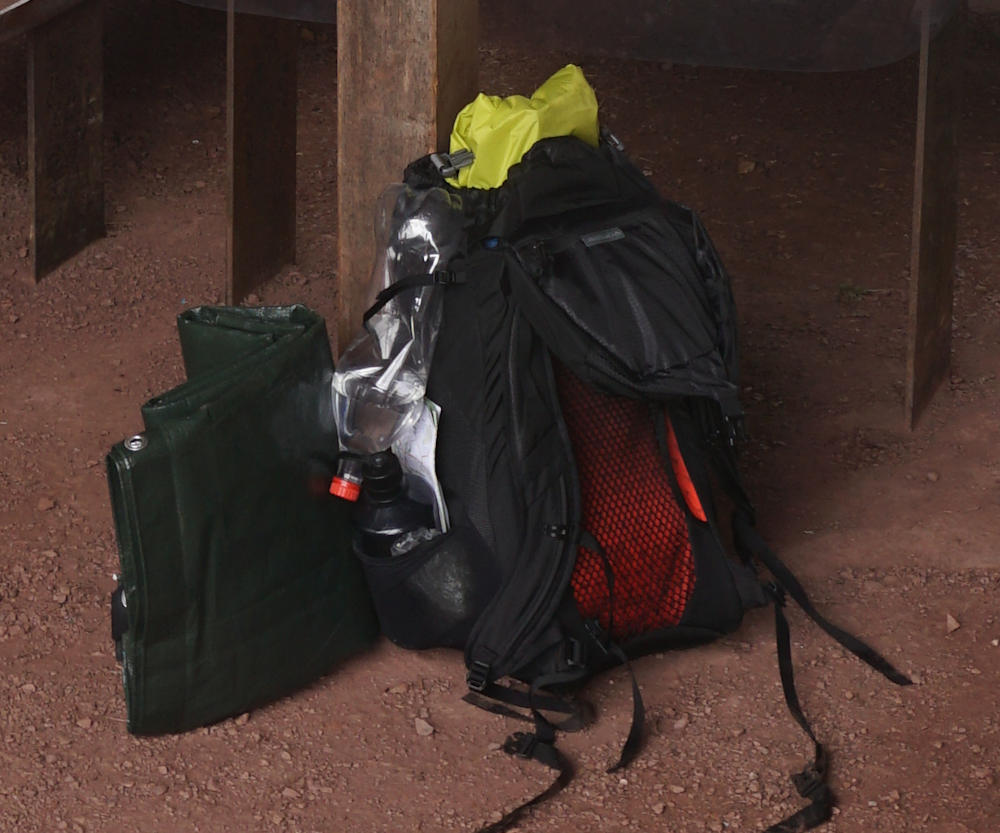
Since I was only hiking for four days and three nights, I stuffed my 24L daypack (Gregory Arrio 24 RC; see photo below) to not have to take my heavier trekking backpack. Surprisingly, I was able to carry everything I needed.
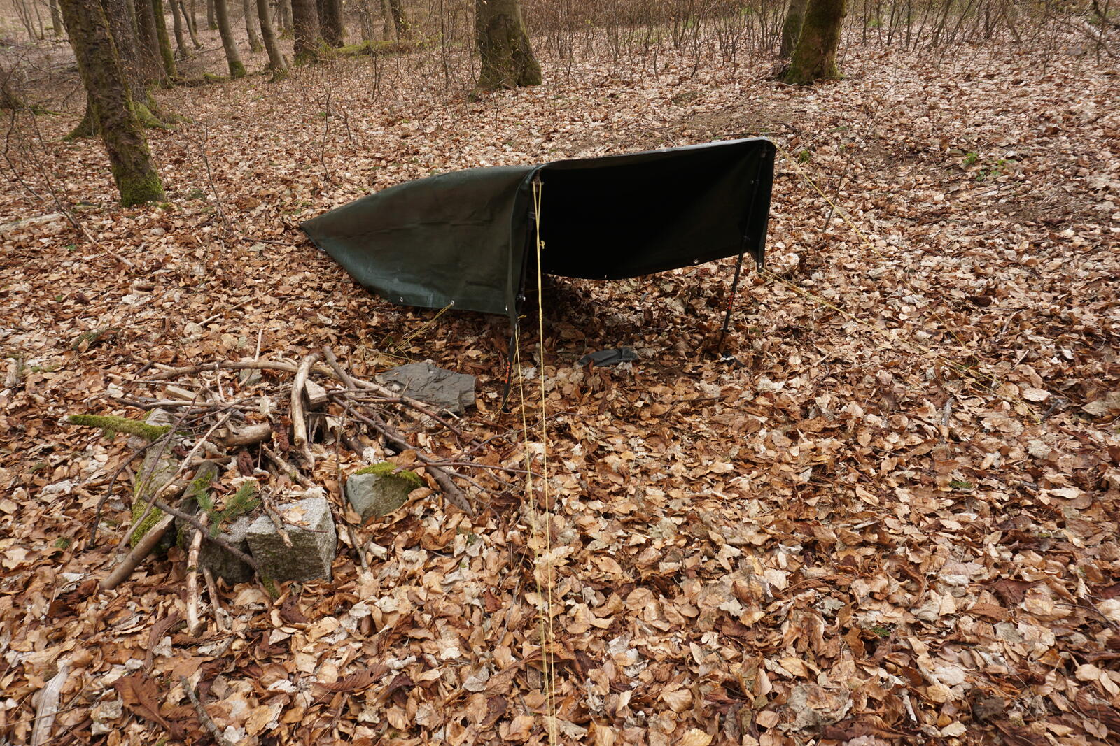
For the overnights, I took my tarp with me. My tent does not fit in my backpack anyway and weighs 2.5 kg / 5.5 lbs more than the tarp. The Tarp is just a green 2x3 m / 6.5x10 ft hardware store tarpaulin with eyelets for 6.50 € from the German Bauhaus hardware store, so no expensive super-duper-ultralight stuff of Hilleberg. Of course, one must take pegs and some cord for the tarp. As supports, I have taken my hiking poles.
In terms of clothing, I brought, of course, long pants, hiking boots, hiking socks and a rain jacket. Plus regular T-shirts and three pairs of underpants and thin and thick socks. I drive the 2-socks strategy (thin sneaker socks and thick hiking socks on top).
For sleeping, I took my Ultralight Air Mat (highly recommended!) from Sea To Summit and a summer sleeping bag from Frilufts with me. But since it was April, I got myself a fleece inlay in addition, which worked together quite well. My winter sleeping bag fits – similar to my tent – not in the backpack anyway.
For cooking, I used my simple Essential Trail Stove from Primus with a normal gas cartridge. I also had a windbreak, which was very useful!
Food
For breakfast, I had a kind of porridge (oatmeal + BP-WR emergency bar + dried fruits). Simple, filling, reasonably tasty and easy to make. In addition, I had an instant coffee.
For the main meal I had two ready meals (Trek’n Eat & Sea To Summit) and a DIY meal of couscous, red lentils, sauce powder and dried vegetables, which also worked very well. In addition, I had a few soups with me to have something warming in the evening in addition to tea.
For in between I had some cereal bars, dried fruit, crispbread and nuts. I had tea, soup, broth and hot lemon (shugar powder with lemon flavour and vitamin C) to warm me up.
Since the Rennsteig is quite well known, you can eat and drink something at several locations along the route (see map above). Even in the off-season, many locations were open.
Overnight stays
I spent all three nights in the forest. The last one in one of the many shelters there. Although wild camping is prohibited in Germany, there are many shelters along the Rennsteig where overnight stays are tolerated.
Weather
The first day it was relatively warm (I guess about 15 °C / 60°F up to 20 °C / 70°F at noon). Around noon, I just wore a T-shirt and let the sun shine on my fur after the Drachenschlucht with coffee and cake.
It was clearly colder on the second day, and I woke up in the thick fog at about 5 °C / 40 °F. It didn’t get that much warmer, I guess it was around 12 °C / 54 °F. Especially with the wind on the Großer Inselberg mountain, it was quite cold.
On the third day, it started to rain at noon until the following day.
So:
Typical German April weather with sunshine, fog, blue sky, rain, warm weather and near-freezing temperatures.
Day 1: Eisenach → Klinzingshütte
Apr 22, 2022
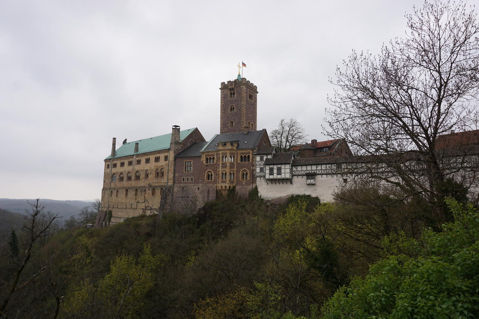
Last day in civilization, so I had a delicious breakfast in a bakery in Eisenach. Strengthened, I then went to the famous castle Wartburg, the climb was for me, a flat-land guy from northern Germany, pretty exhausting. Not to be compared with the ascent of the Zugspitze , but still exhausting. Arrived at the top, I had taken off all jackets and was already sweating wet to some extent. But the view was worth it! In the courtyard is the south tower, which you can enter for one euro – you should invest that one euro for the view!

Past the restaurant Waldhaus Sängerwiese, I went on to the Drachenschlucht (Dragon Gorge, a really narrow gorge), one of the highlights of the Rennsteig. If you are near the Drachenschlucht, you should definitely pay it a visit, it’s worth it!
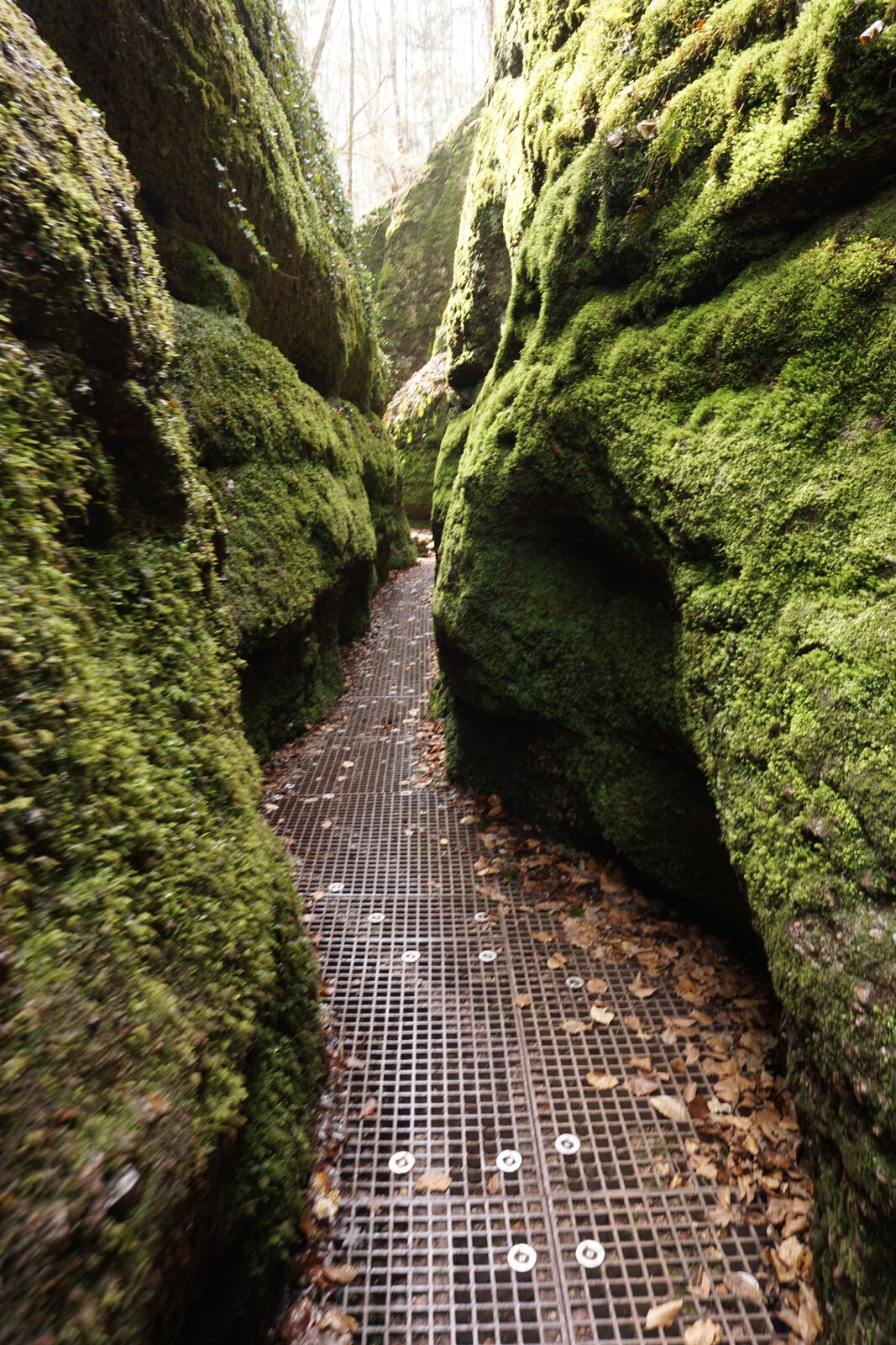
It was a little bit more busy there and soon the first people were audibly annoyed about their inadequate footwear. A father was so annoyed because his new sneakers got dirty that he angrily stamped his foot, splashing his entire pants with mud and stomped off with a nasty look … along with that sloshing sound of his wet sneakers. Mother and daughter rolled their eyes and I felt a little sorry for them, the joy of their trip was probably gone.
Especially in the later (southern) part of the gorge, sturdy hiking shoes are simply a must! Not only are there a lot of stream crosses and fords, but the way runs partly within the still young and muddy stream.
Shortly after the Drachenschlucht comes the hunting castle “Hohe Sonne”, with a nearby snack bar where I enjoyed coffee and cake in the sunshine. At this point, I had already completed half of the planned kilometers for the day and it was only 1 PM, so I still had plenty of time.
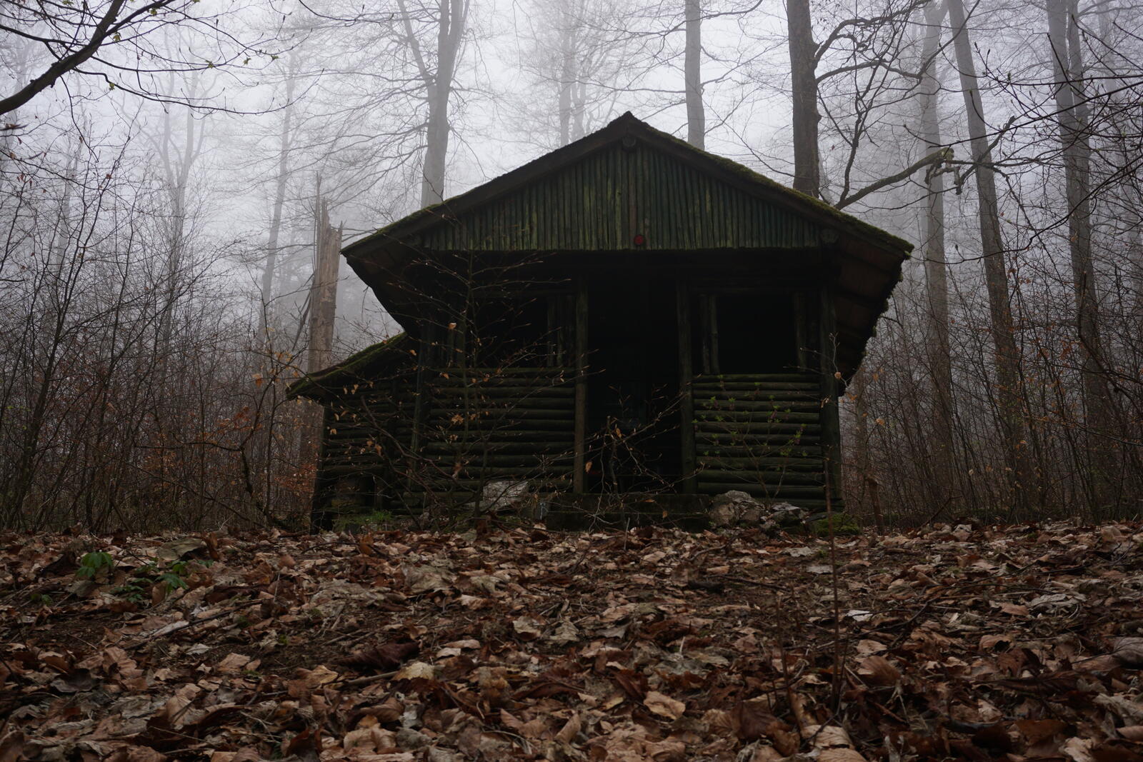
Then it went past the forest inn “Hubertushaus” and the mountain rescue station “Auerhahn” to the forest hut called Klinzingshütte. But it is well hidden in the forest and I had to search a while until I found it. It is not a public hiker’s hut or something, much more a shed that someone just had built there.
The hut itself was open, but it was too narrow and dirty for me to spend the night in it. But on the porch, I have cooked my dinner and for the night, I put up my tarp nearby.
Day 2: Klinzingshütte → Bärenbruch
Apr 23, 2022
Shortly before 7 AM, I got up and was in the middle of a heavily foggy fairy tale forest. Spooky but also very beautiful.
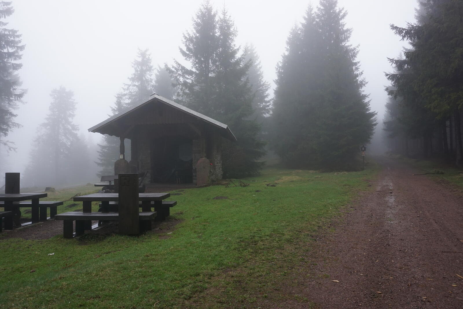
I had breakfast at a hut called Glöcknerhütte after a few minutes of morning hiking. The hut was dry, clean, sheltered from the wind and furnished.
At around 8 AM, I continued and already met the first joggers and people with dogs. At the snack bar Imbiss zur Wallfahrt near the Schillerbuche, I continued along the hardly traveled L1127 road to the forest tavern Dreiherrnstein.
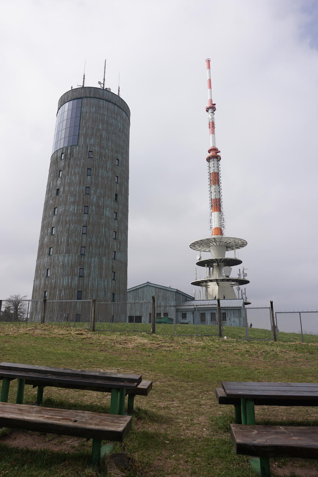
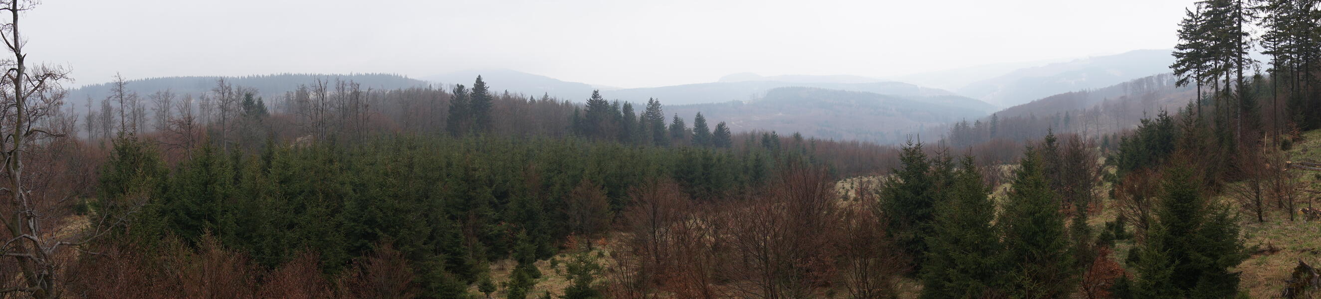
After a short break and another 5 km / 3 mi, I reached the Großen Inselberg mountain at 916 m / 3000 ft, the highest point of my tour. The highest point of the whole Rennsteig is with 983 m / 3225 ft the Großer Beerenberg further south. Even in the somewhat hazy air, one occasionally had a great view. On the summit, I treated myself to a coffee and met a group of hikers who wanted to make the entire Rennsteig trail.
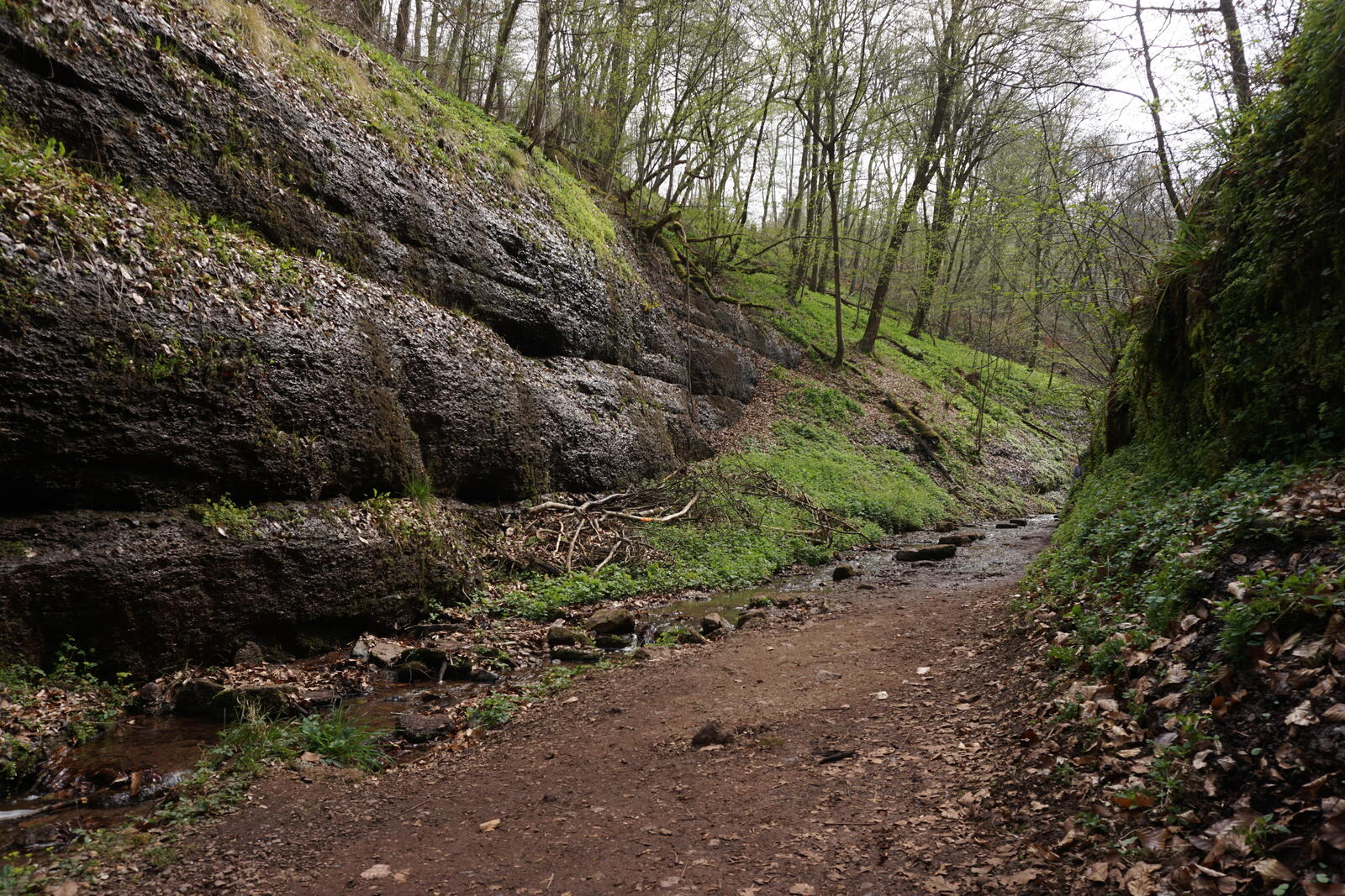
After strengthening, I had to go down the mountain. At the Inselberg parking lot, I went past the cart track built there to the northeast in the direction of Bärenbruch. It went along different brooks steadily downhill.
At a fork of several streams was another hut (a sign nearby said Am Tempelchen), where I made myself somewhat fresh at the creek. It was only afternoon, so I have also killed some time there, but I finally went further up the Bärenbruchgrund to the Bärenbruchwand, where I built my camp.
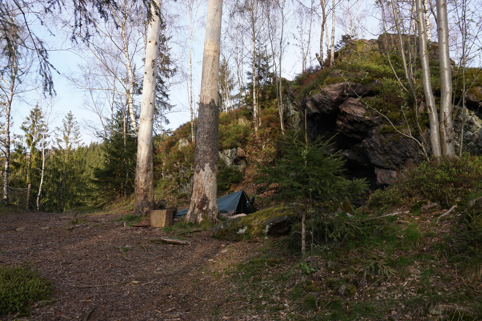


As you can see above, I stretched up the tarp with one central hiking pole. The entrance is therefore somewhat blocked, but the tarp reaches the sides to the ground so that hardly any wind comes into the tarp. I highly recommend this setup.
At the camp itself – one of the most beautiful I ever had – I was completely offline. But I had just enough network to make a phone call when I climbed the rock above my camp.
Day 3: Bärenbruch → Wachsenrasen
Apr 24, 2022
During the previous day’s break, I noticed that I lost my rain pants. I tied them to the outside of the backpack, which apparently didn’t hold.
Everything that is not secured with a carabiner or otherwise belongs in the backpack!
So after breakfast, I left and walked the almost 4 km / 2.5 mi back to the parking lot at Inselberg, hoping to find the pants somewhere along the way. Unfortunately, I found nothing, so I had to get along with just my rain jacket.
Matching this mishap, it then started to rain at the parking lot, but rather sporadically and not particularly much. However, my rain jacket was not the youngest anymore and, even with a fresh impregnation, no longer really waterproof. However, this slight rain was no problem.
I followed the Gelber Weg trail, a parallel path to the Rennsteig, and only changed at the Gabelwiese back to the Rennsteig.
The rest was rather unspectacular, but it started to rain more strongly from the mountain inn Heuberghaus. At least the path from here on was quite beautiful and the forest was not particularly heavily farmed.
Until the quarry Splittergrund, I was already well wet and wanted to dry my things and drink something warm in the mountain hotel Ebertswiese, but unfortunately, it was closed. In a hut a little further, I took a break, ate something and made myself a nice warm tea. Meanwhile, My rain jacket was somewhat overwhelmed, so I was already wet even under it.
On the way to the kiosk Rennsteighaus Neue Ausspanne, it really started to pour – I was well wet even under the rain jacket.
Take working raingear with you!
I arrived at the kiosk and allowed myself a coffee and a hot lemon. There was another hiker there warming up. His name was Kristian and he planned – just like the group on the Inselberg – to walk the whole Rennsteig together with his young dog. We had a nice chat and he left a bit before me.
A little later, a bit behind the viewing tower “Kramerod”, we met again and continued our hike together. In company, it was much nicer and the next six kilometers just flew by. Although his dog was still relatively young, she was fully involved, found the nature around us super exciting and wanted to explore everything.
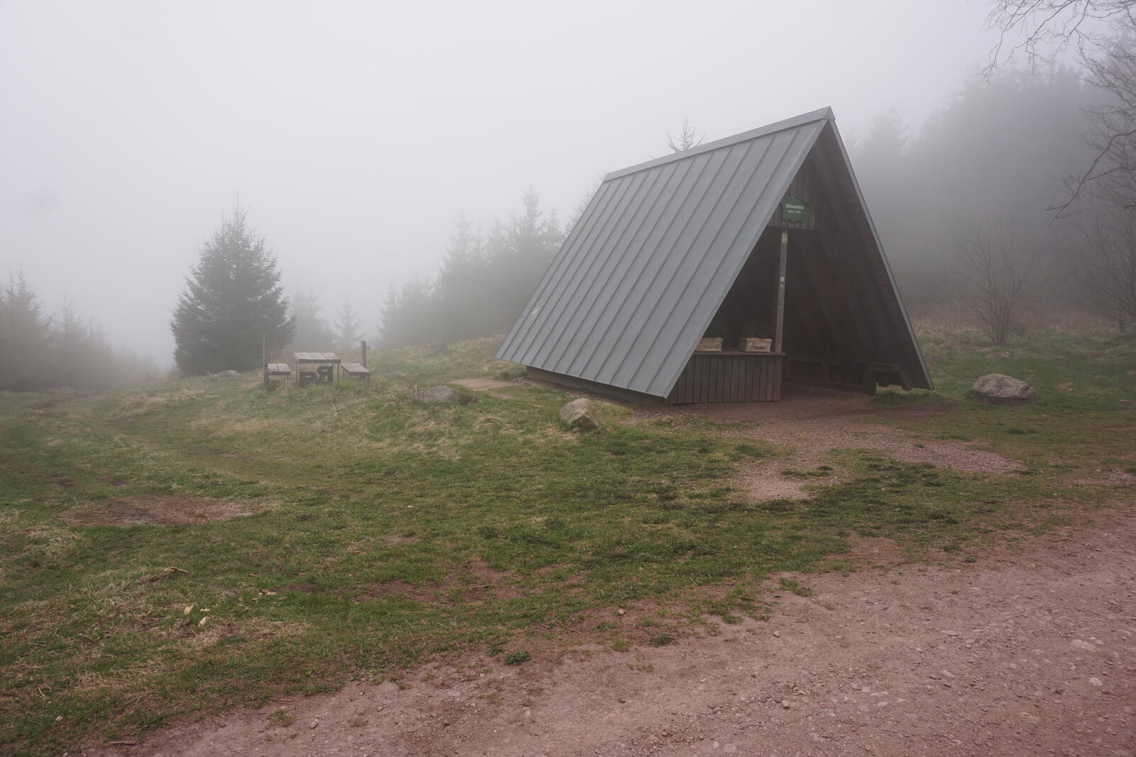
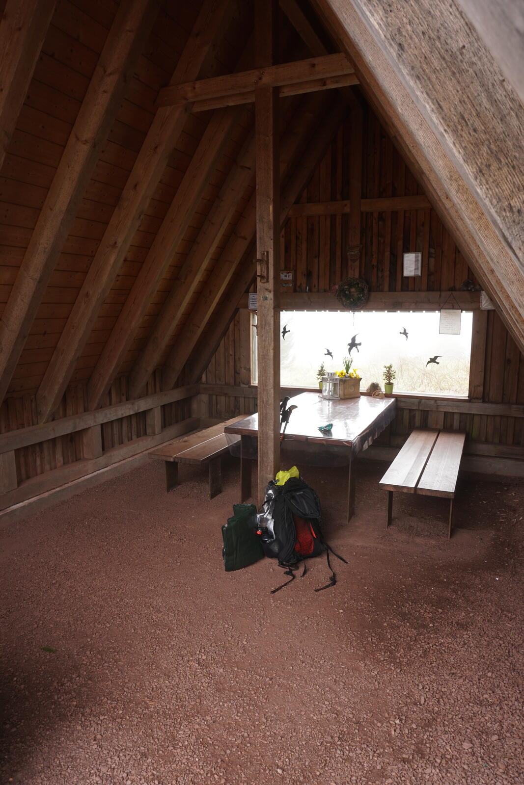
At the hut Wachsenrasen, we made a break. I wanted to set up my camp directly there, since I wanted to go to the nearby Steinbach-Hallenberg on the next day, from where I wanted to go to Meiningen. Kristian then also set up his camp in the hut, so we both and his dog have spent the night there.
The hut is completely open on one side, but no rain came in, it was wind-protected and dry. Unfortunately, there was quite a lot of garbage lying around behind the hut, but it was clean and dry inside.

Kristian and I talked a lot about hiking. He was amazed at the little luggage I had with me, but he on the other hand packed a few things too much. But that’s always the problem that you like to pack too much, a small backpack helps to concentrate on the essentials.
Day 4: Wachsenrasen → Meiningen
Apr 25, 2022
In the morning, it was still quite hazy and cold. Kristian and I had breakfast together and then said goodbye. For the two, it went on towards the Saale river, for me to Steinbach-Hallenberg.
I hiked along the Königsweg trail, an easy hiking trail that only consists of forest tracks. From time to time, however, one has a very nice view over the landscape and the villages of Ober- and Unterschönau.
After a short time, I reached the train station in Steinbach-Hallenberg and my first multi-day hiking tour after Corona was over.
Conclusion
Despite the ready-made trail with lots of infrastructure, tourist attractions and little wilderness, it was a lovely hike.
However, one will directly notice the many places where the forest is used and trees are cut down extensively. Such passages are, of course, not nice to hike. But places like the Drachenschlucht, the Inselberg, Bärengrund or the many viewpoints make this tour really nice.
So:
Definitely worth a trip and maybe I’ll do the rest of the Rennsteig sometime.