Iceland 2018: Travel report (part 4)
Day 13: Sveinstindur emergency shelter → Langisjór
Jul 30, 2018
After a good night of sleep, we made a nice breakfast in the emergency hut, which was a very nice, small, old but cosy. On the wall, there was an old map of the Langisjór from 1959, which fitted into the age of everything else in this hut.
Shortly after 12 p.m. we started our way to the Langisjór lake. On our way, we found the actual Sveinstindur hut, which is marked on our hiking map and which we originally wanted to reach. Again it was a Útivist hut which was rented to a group of people so that we weren’t able to sleep there anyway.
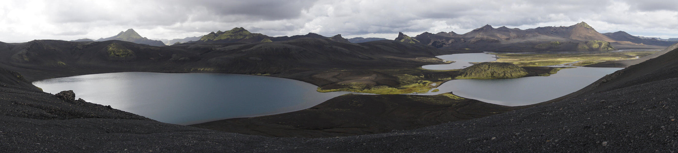
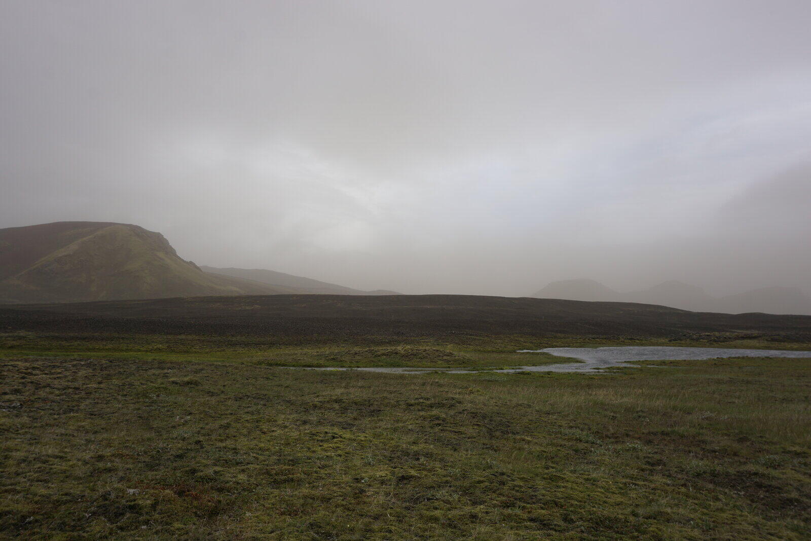
After a quite steep and windy ascend onto a mountain ridge next to the hut, we soon reached the Langisjór. We walked the last bit on a track “Sveinstindur” which was parallel to the F-235.
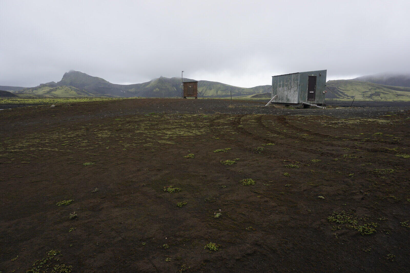
There was a large parking space and a campsite, which was closed at that time so we weren’t able to book any space there. Besides the campsite was unbelievably ugly, just an area of gravel next to the parking space. No trees, no bushes, nothing but the campsite hut and gravel.
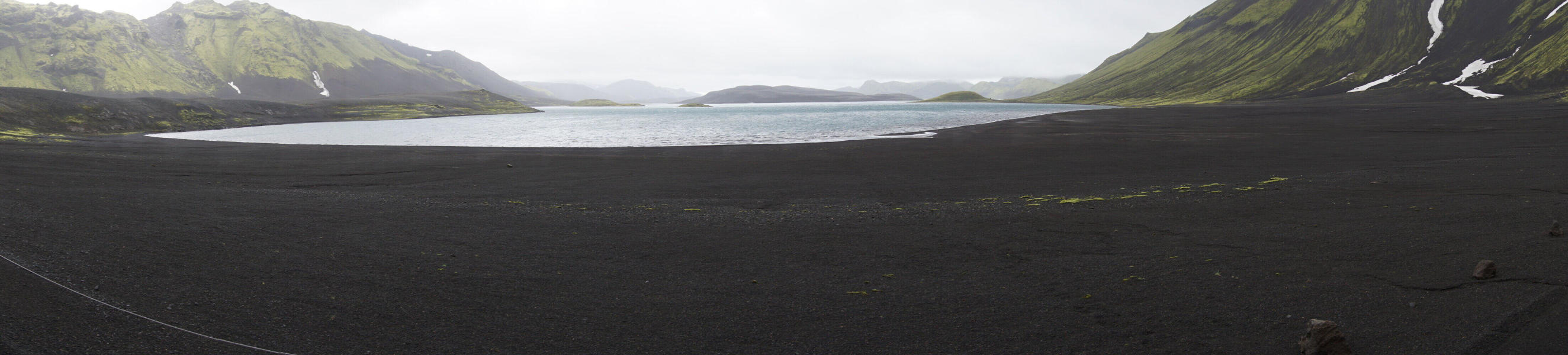
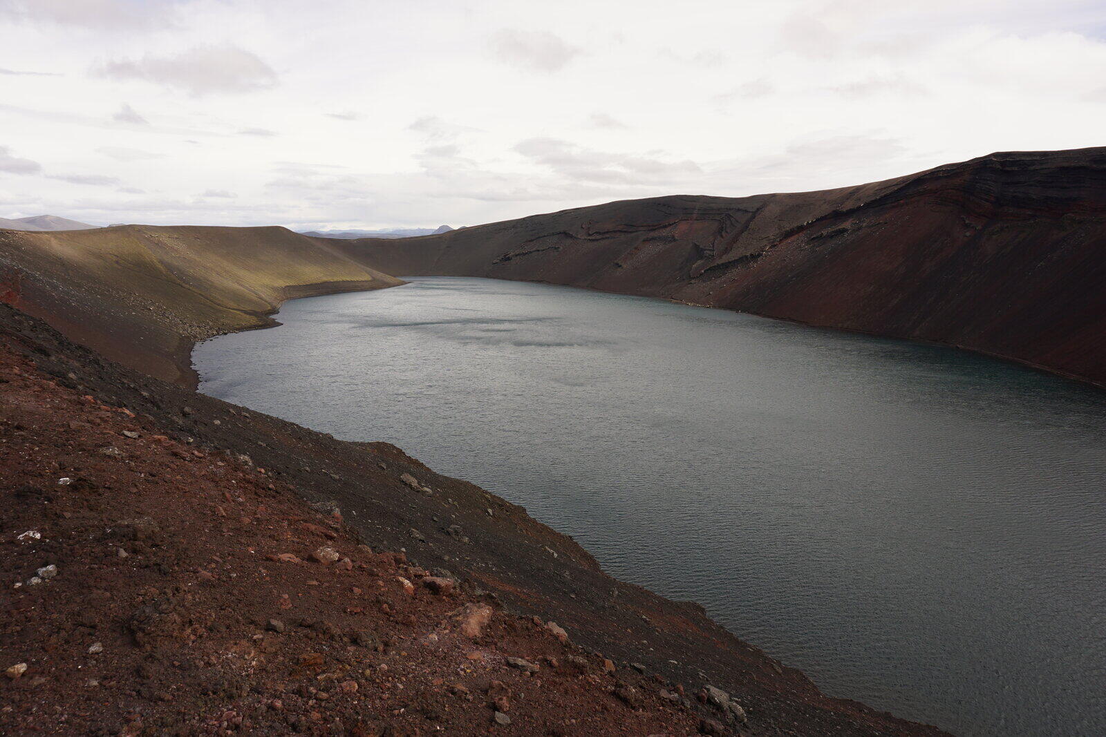
On a promontory within the Langisjór, there was another hut and we had the hope to sleep there. After visiting a nice viewing point, we went to that hut and discovered that it was closed and locked. It wasn’t a Útivist but a private one that you can rent.
It was also very cold and windy so we weren’t able to build up our tent (6°C/43°F, rain and hurricane-like gusts). We thought of building up our tent in the wind shadow of the hut but suddenly a jeep drove towards us and a French tourist family arrived which rented the hut.
We asked them if it would be okay if we camp on their porch but the father of the family directly invited us to come in and offered us the couch to sleep on. The hut had a small sleeping room with four beds and one sleeping-couch in the living room. Because it was a family of five, the father and mother shared one of the small beds so that Kristina and I were able sleep on the couch. People could not be more hospitable and nice – unbelievably!
It was the last day of their vacation so they had enough food so that they also made dinner for us as well. Rice with some spicy pesto. Quite simple but after 13 days of tracking meals and mashed potatoes, it was like a feast for us. After dinner, we played some cards and had a nice conversation.
The hut even had a gas heating so that it was nice warm and cosy and we immediately fell asleep.
Day 14: Langisjór → Lónakvísl
Jul 31, 2018
The night was awesome. Sleeping in a real bed (even if it’s a sleeping couch) is pure luxury.
We ate our usual porridge for breakfast, which was unusual for the family because we both crumbled one BP-WR bar into it. In addition to that, we both also put nuts and dried fruits into it and I also added coconut flakes. The family had some YumYum instant noodles as breakfast.
They also gave us some leftover supplies like tea and German alphabet soup with an Icelandic label glued onto it. It was even better: they took our garbage bag with them. That was particularly nice because it gained some serious weight and started to smell.
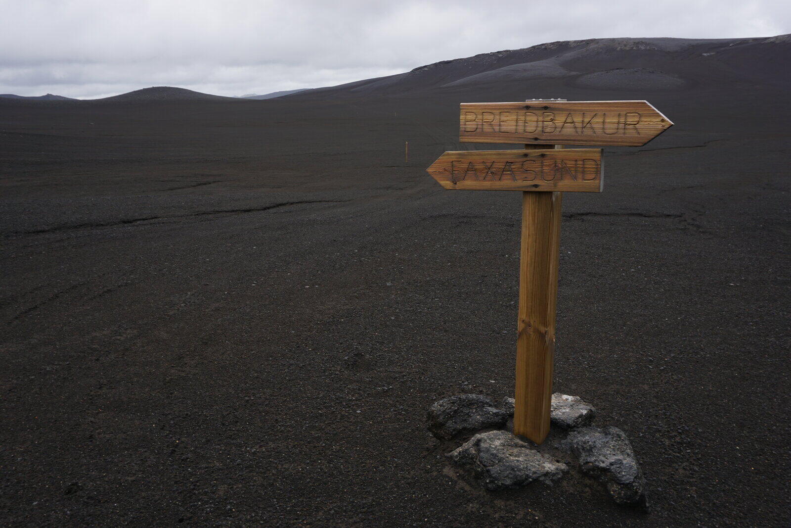
We then said goodbye, they left to Keflavík and we stepped through wind and rain towards Faxasund. We never experienced such a lovely encounter before, unbelievable!
Our mood was good and we considered the starting second half of our hike as the way back. The weather suddenly became better as we passed the mountain ridge between Hrútabjörg and Grænifjallgarður heading for the Tungnaá. Note: Mountain ridges are sometimes like weather borders.
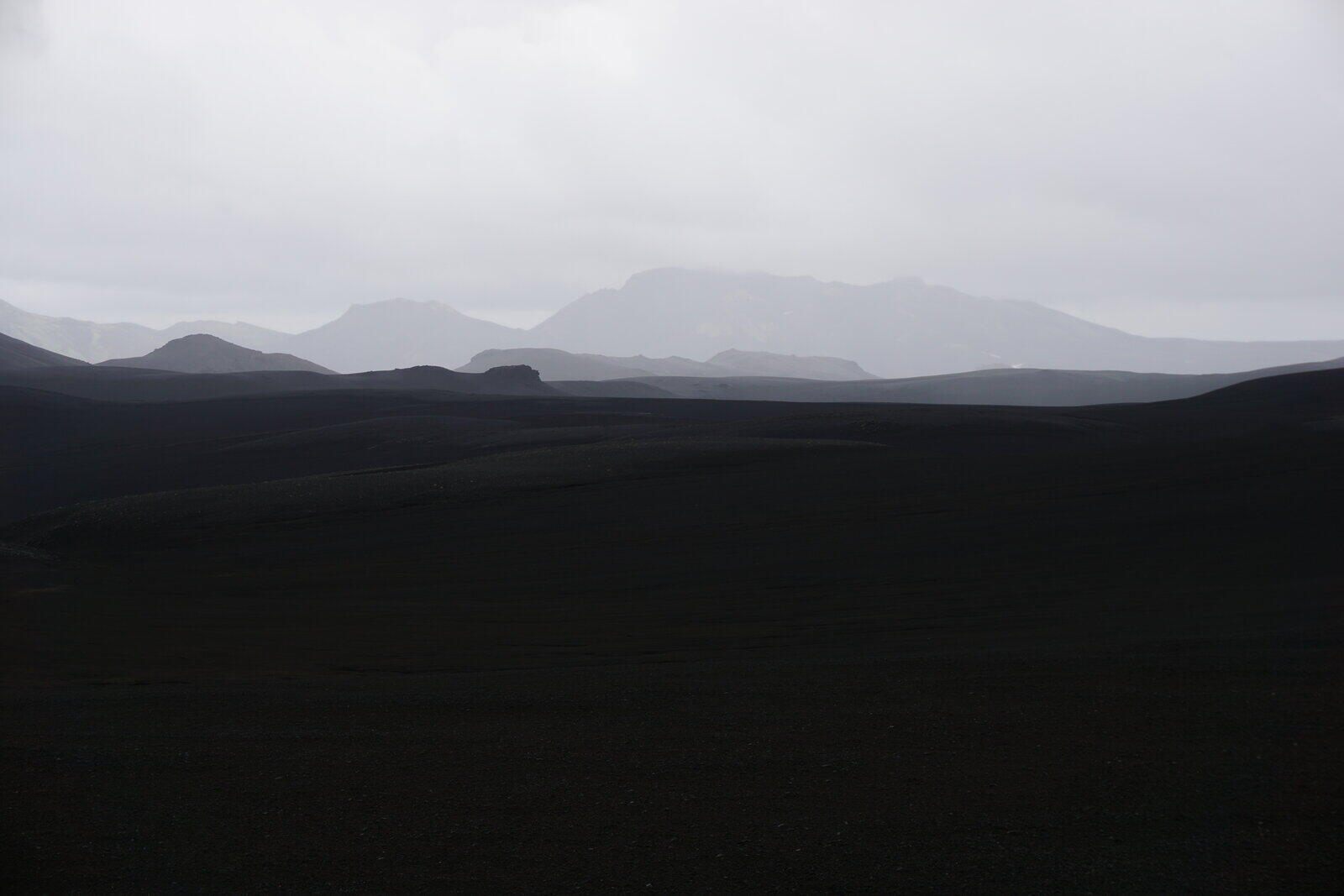
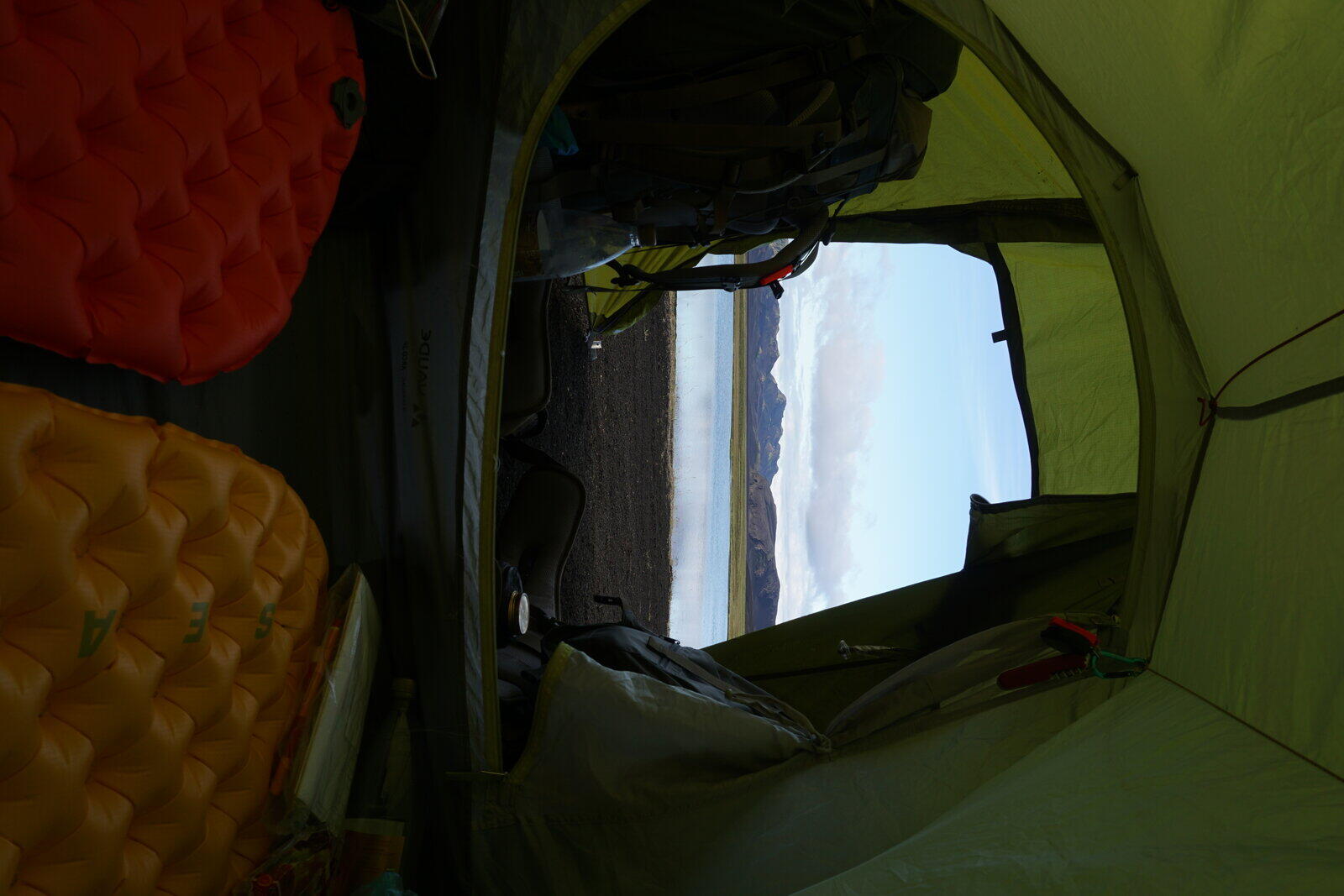
The landscape was beautiful in its typical Icelandic way: Black sand and endless expense. Our goal for this day was a lake near the river Lonakvisl where another hut was located on our hiking map.
On a hill, we had a good view over the landscape and were even seeing the hut on the lake. The descent was a bit adventurous (the slope was very steep) and we had to cross a smaller stream.
Unfortunately, the hut was a private one but not rented by anyone, so we just pitched up our tent next to the hut. Because it wasn’t too late, we were able to relax and watch the beautiful sunset.
Day 15: Lónakvísl → Faxafit
Aug 1, 2018
Because we didn’t want to get caught camping on private property, we stood up and left pretty early.
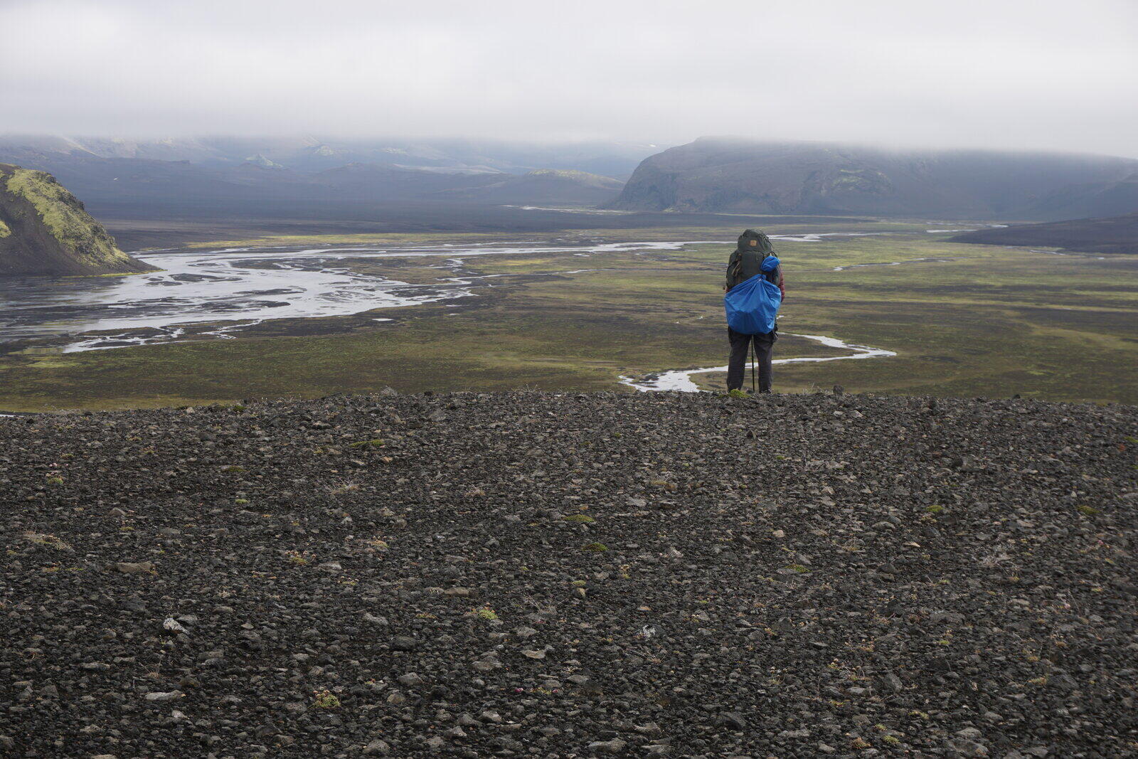
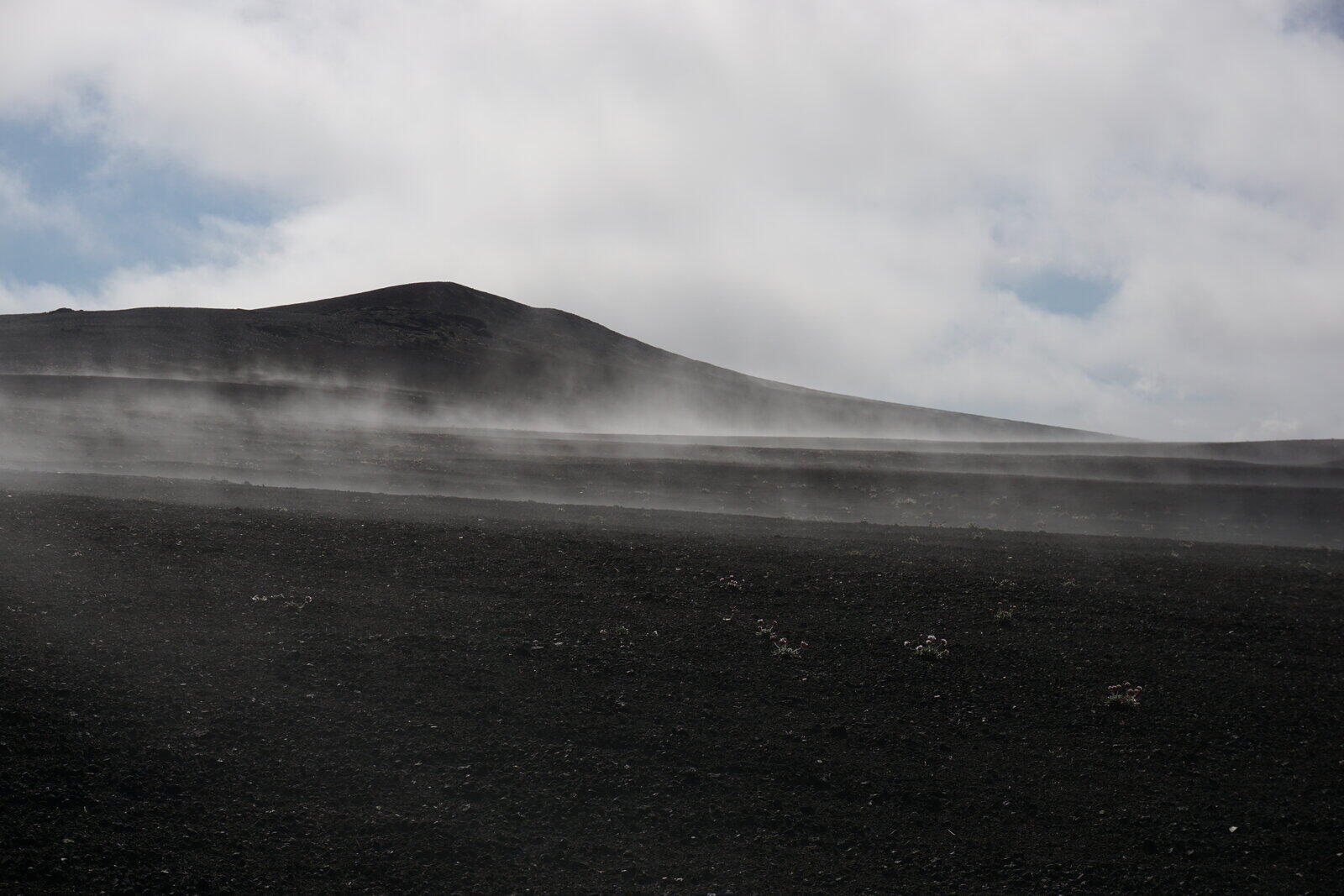
Because there were very few clouds, ground fog was building up and we made a break to also take some photos.
At noon, we climbed onto a mountain peak a bit north of Faxi and ate lunch there. We had an awesome view over the landscape, the Tungnaá and a lake with another small hut (probably a private one).
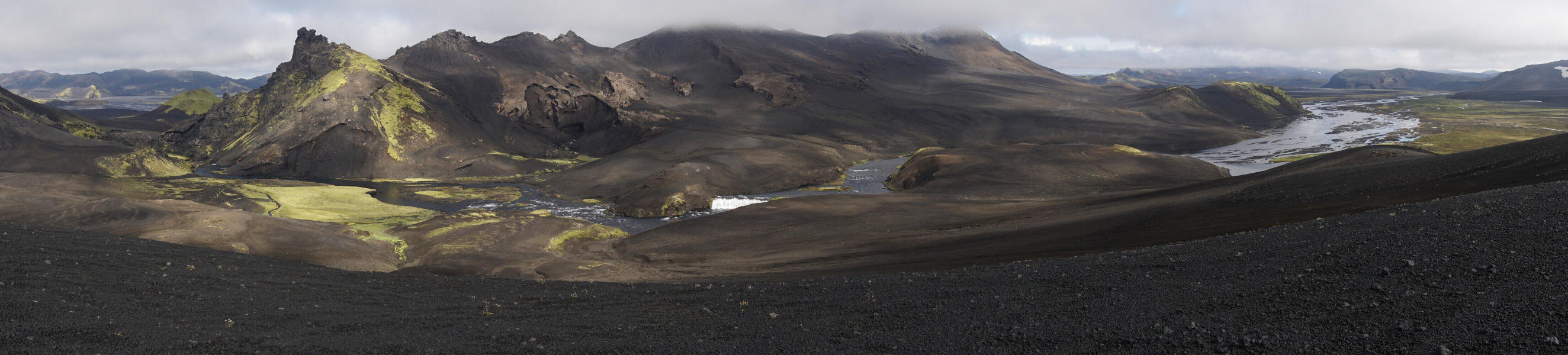
After having lunch, we followed a track through a small canyon through the Faxi mountain ridge to the other side where the Tungnaá flows. In parallel with the Tungnaá there’s a track in quite good condition where you can hike or drive without any problems. This was quite nice for the end of our hike, even if this was a bit monotone.
About half a kilometer later, there was another small canyon through the mountain ridge with a stream as well. This place was called Faxafit but we don’t know if this is the name of the canyon or the region.
Because it was noon and this place was quite nice, we stayed here and pitched up our tent. Unfortunately, this place was a hotspot for mosquitos and we covered ourselves with towels and scarves because these little creatures are really annoying. However, they fortunately don’t bite so we were able to wash ourselves and our clothes in the stream.
Day 16: Faxafit
Aug 2, 2018
Today was a pure rest day and we relaxed and chilled the whole day over, talked, ate something and went to bed early. When we planned our hiking route we added some days as a kind of security buffer, which we can now use up.
Day 17: Faxafit → Stakihnúkur
Aug 3, 2018
The ford over the stream at Faxafit wasn’t too small but wasn’t a big problem and quite refreshing.
After that, we headed southwest in parallel to the Tungnaá. We encountered some smaller fords but nothing serious.
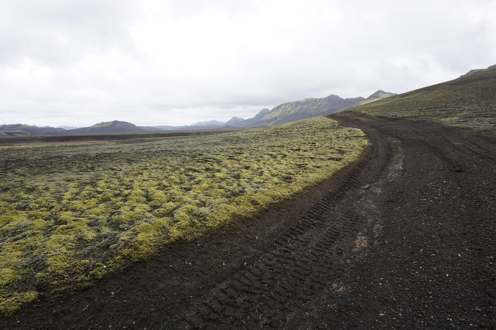
Later during the day, we reached an area of swamp and wetland where we left the track and just followed the Tungnaá off-road. It soon became more green and more diverse, which was quite nice.
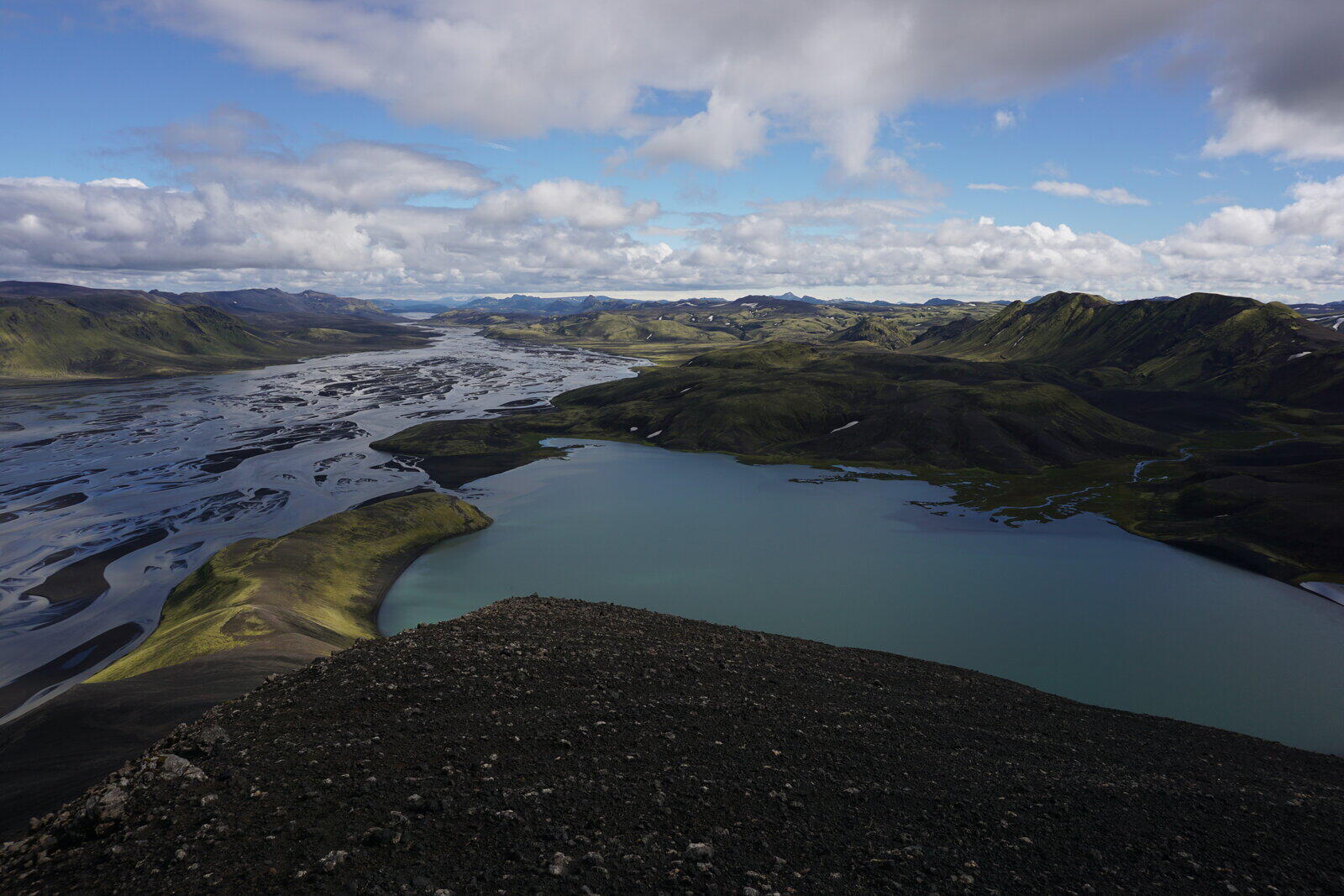
After avoiding hills and streams with magnificent slaloms, we reached a turquoise-blue lake at the bottom of the inactive volcano Stakihnúkur. The lake and our campsite were amazing and we pitched up our tent next to an old and bit overgrown track.
Day 18: Stakihnúkur
Aug 4, 2018
We again decided to make this a resting day, but we weren’t just chilling and lying around. Instead, we had the idea to climb the Stakihnúkur (810 m / 1650 ft above sea level or approx. 210 m / 688 ft above our camp). Nothing really serious, but the slope is quite steep with a 45° angle.
During breakfast, we opened the second of our three bottles of fuel, so we bought way too much of it but at least we were safe and didn’t run out of fuel. That also means that one liter of fuel is enough for two persons for about two weeks.
After breakfast, we climbed the Stakihnúkur with some light gear (camera, something to drink and some snacks). The ground was solid (no loose sand or gravel) but sometimes a bit fragile, so you need to be careful there. So definitely feasible, even without mountaineering equipment.
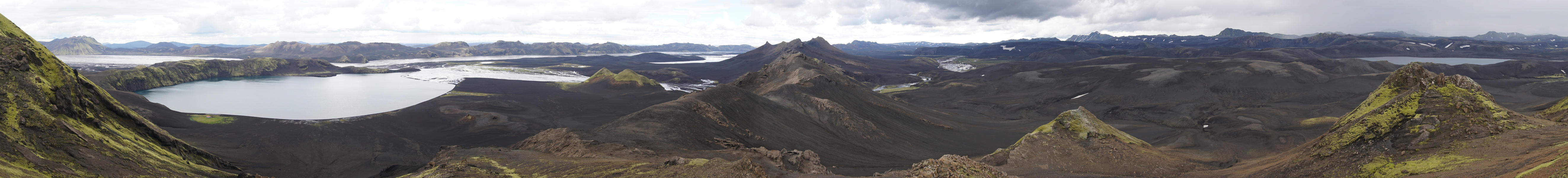
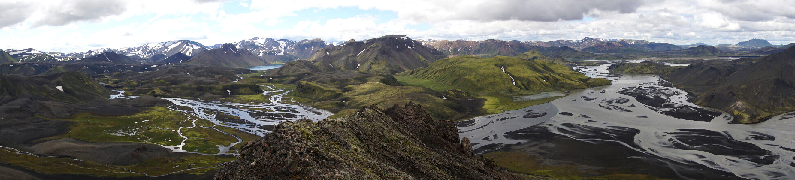
On the summit you’ll probably have one the greatest views that exist in Iceland: To the north, you can see the complete Tungnaá all the way to the Vatnajökull glacier and to the south/west we had a great panorama view over the Landmannalaugar region.
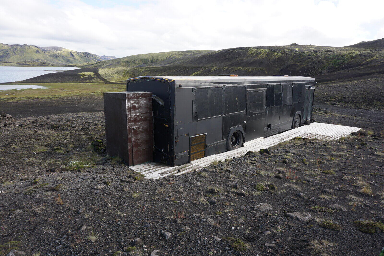
At the foot of the mountain, there was an old bus, which was painted completely black (as camouflage? For heating?) and was used as a kind of fishing hut. On the inside, there was all kind of fishing nets, equipment and some whiskey.
Later during the day, it became really warm (about 25 °C / 33 °F) and we took a bath in the lake. Kristina was even swimming a little bit, I just cleaned myself up. Because the lake was very shallow (you can walk right through to the other side), the water wasn’t completely ice cold anymore.
Our solar panel also had to work hard that day, best investment ever!
Only in the evening it became uncomfortable and started to rain, but that wasn’t too bad because it expelled all the mosquitos.
Day 19: Stakihnúkur
Aug 5, 2018
In the morning the weather was already to complete opposite of yesterday: Stormy and rainy. We had one reserve day so we decided to stay inside and did nothing interesting. But a complete resting day was quite refreshing.
Day 20: Stakihnúkur → Tjörvafell
Aug 6, 2018
The weather on this day wasn’t great but definitely better than the weather on the day before, we even had sunshine from time to time. In the late morning, we went off in the direction of the F208, the main road to Landmannalaugar.
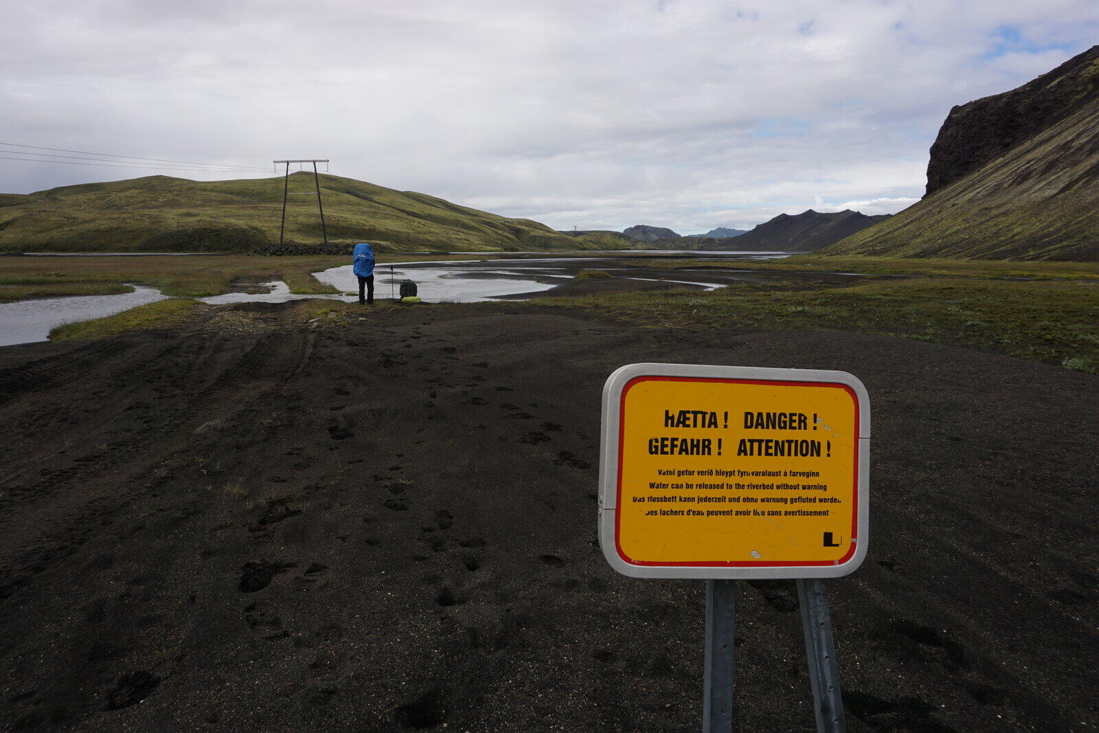
However, the river Jökuldalakvísl was between us and the F208 and we were worried a bit because it was quite large on our hiking map. Warning signs about quicksand and strong currents didn’t give us courage at all. But luckily there was a mixture between a bridge and a ford: They put huge pipes into the water, through which the water flows, so you can drive or walk over them.
On the other side of the river, we visited the hut “Höll” and reached the spooky calm F208. We expected a lot of traffic since it’s the connection between Landmannalaugar and the south.
Once we reached the crossing with the F224, which leads to the campsite, we saw that the F208 was actually closed. While having a break, we saw a jeep coming towards us from the closed side of the road, the driver stopped and asked whether we are Germans and of course we affirmed. Then he asked if we hiked along the Skaftá and wrote something into the books on the huts there, which we also affirmed. Then he said: “Well maybe you are the two Germans we are searching for a few days”. In that moment our hearts sank into our boots.
He told us that the Vatnajökull had a little eruption and that there was a glacier flood at the Skaftá. The whole area around the Skaftá was closed and evacuated up until Landmannalaugar. During the evacuation, a German couple went missing but they wrote down their hiking plans in the books of the huts there.
Some minutes later and woman from a rescue team arrived and gave the all-clear: They found and rescued the Germans who became enclosed by the Skaftá and made an emergency call. What a coincidence, that another German couple hiked the same route just a few days after we went there!
After that slightly frightening moment, we went on and searched for a ruin near the Frostastaðavatn lake, which we didn’t find. In the evening the wind became really strong and we built our camp a bit east of the Tjörvafell mountain.
Day 21: Tjörvafell
Aug 7, 2018
The wind became even stronger during the night and shook us through (according to an online wind map at about 16 m/s, so about 60 km/h / 37 mph) and even pulled a tent peg (22 cm / 9 in) out of the ground.
During breakfast the air outside became more and more hazy and after a while we weren’t able to see the hills of the Ljótipollur 700 m / 2300 ft away from us. Once I went outside I noticed that we were trapped inside a sandstorm.
The sand even came into our tent so that everything started to scrunch a little bit.
We stayed inside the whole day, because we had sand in our eyes as soon as we went outside, and hoped that the wind wouldn’t destroy our tent. In the evening, we tried to cook something warm but due to the wind half a liter took us half an hour to cook.
Day 22: Tjörvafell → Landmannalaugar
Aug 8, 2018
Luckily the wind calmed down over night and also the air became clearer. We went off after breakfast and visited the Ljótipollur (which means “ugly puddle” in English). It wasn’t ugly at all but on the other hand also not really beautiful compared to other places we saw.
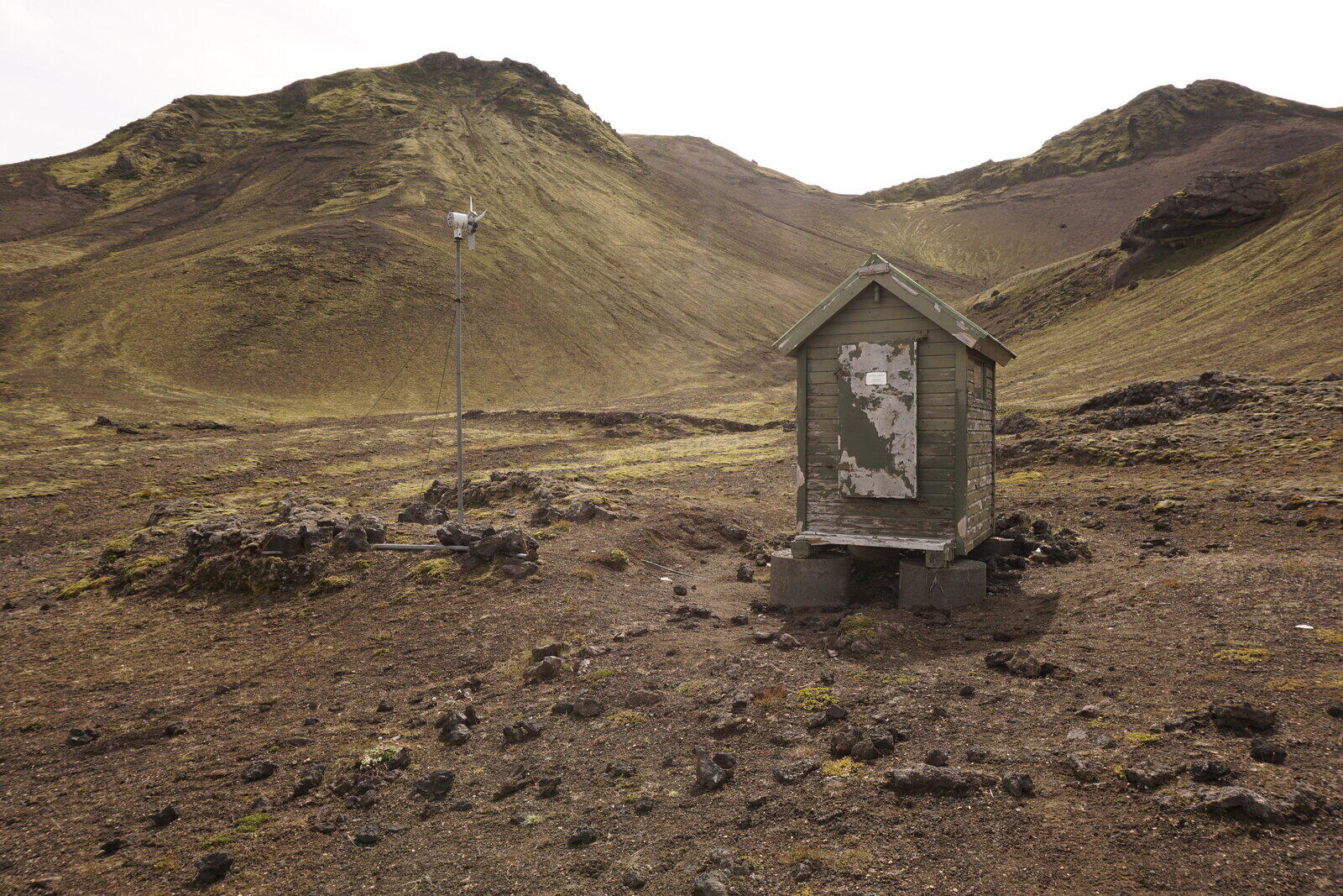
After passing by an old seismologic measuring station we went on to the top of the volcano Stutur and made a break there. After that, we finally went to the Landmannalaugar campsite.
There is no pure footpath towards the Landmannalaugar campsite, so you constantly walk on the F224 road. Alternatively, you can also use hiking trails over the nearby mountains.
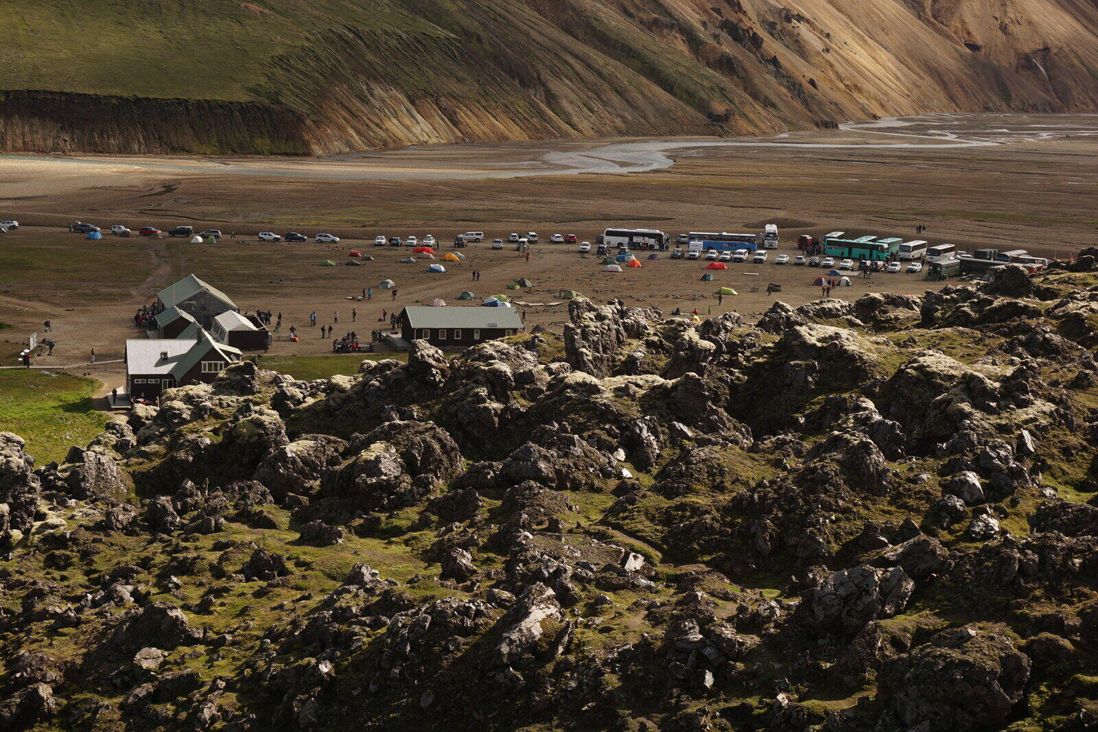
Once the campsite came into sight we were a bit shocked: Already half a kilometer before reaching it there was a huge parking area crowded with cars and buses which were even parking right on the street because there wasn’t enough space left. Even the parking spaces around the actual campground were completely crowded.
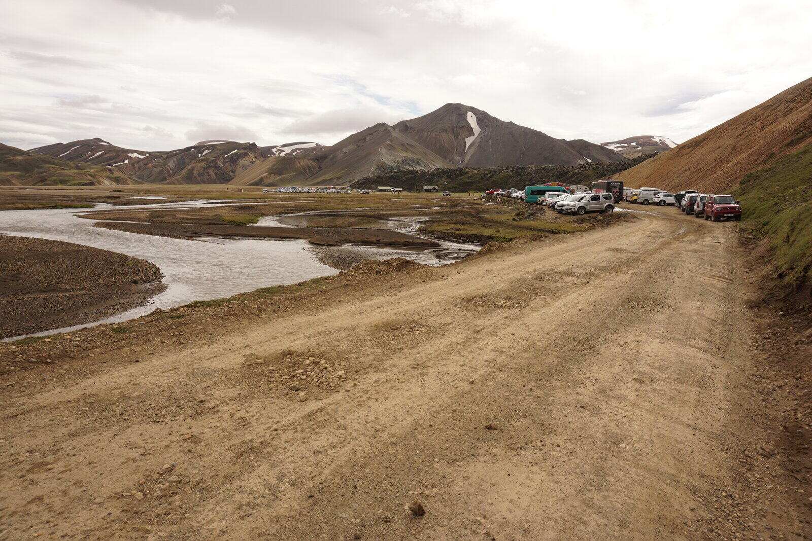
the campsite itself was large and not really suitable for camping: Rock hard soil and a lot of sharp stones on the ground. One night with two adults cost us 4000 ISK / 32 € / 38 $ and showering was an additional 500 ISK / 4 € / 5 $.
So we pitched up our tent and started to mourn because our journey finally came to an end.
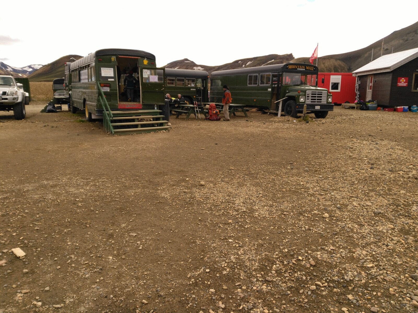
On the campsite, there was, next to an information hut, also a really tiny supermarket within an old school bus. We bought some very expensive triple-choc-cookies (500 ISK / 4 € / 5 $) and two apples (each 100 ISK / 1 € / 1 $).
On the next day at noon, our bus back to Reykjavík left but we were able to change our bus ticket so that we would arrive earlier in Reykjavík. Changing the ticket without extra costs, without cancellation fees, simply by a phone call – Awesome and unimaginable in Germany!
Day 23: Landmannalaugar → Reykjavík → Keflavík
Aug 9, 2018
Let us not talk about the night (noisy, uncomfortable, hard ground, …) but the breakfast was really good, because we bought some “Koko-Mjöll” (so chocolate milk for each 250 ISK / 2 € / 2 $) and blueberry muffins (each 500 ISK / 4 € / 5 $ but definitely worth it).
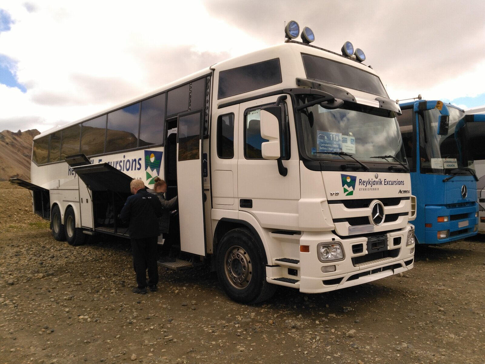
In the morning we went for a small hike in the nearby Laugahraun lava field but the bus to Reykjavík left at 1 p.m. The bus was actually a modified truck with the rear part built into a bus. Awesome vehicle! The drive to the Hekla volcano was quite rough but until then the road was paved and therefore the journey became more comfortable.
In Reykjavík, we went the same route as three weeks earlier from the BSÍ to the inner city. At a Bonus supermarket, we bought some licorice and Icelandic fish jerky.
Finally – as it should be for real tourists – we went to several souvenir shops and noticed that all the shops sell the same stuff and none of them is significantly cheaper than the others. We then bought two shot glasses with pictures of Thor and Freya on them.
We then had some delicious fish and chips at the fish restaurant “Reykjavík Fish” and got some good licorice ice cream at “Valdis” right next to the restaurant (300 ISK / 2,50 € / 3 $ per scoop).
At the ice cream shop we met a couple from the USA we saw earlier at the fish restaurant and who rented a B&B flat on the other side of the street. We had a nice chat with them, Travis and Vanessa, and nearly forgot our bus so that we had to leave quickly. We had 20 minutes left to catch our bus and barely made it to the BSÍ. So when you walk fast enough, you can walk in 20 minutes from the BSÍ to the inner city.
However, we got the bus and went to Keflavík. Because our flight leaves on the next day, we booked a small hut in Keflavík at “Alex Guesthouse”, which offers a shuttle service from/to the airport. Very nice!
We had the hut all for us alone and really enjoyed the thermally heated water in the shower even though it smelled a bit like sulfur of course. A perfect ending for our trip.
Day 24: Keflavík → Hamburg
Aug 10, 2018
Well, at 4:15 our alarm clock rang after ca. five hours of sleep and we went straight for the breakfast and the shuttle service which brought us back to the airport. There we did a self-check-in, gave the remaining fuel to the personnel there and checked our backpacks as bulk luggage in.
Of course, we went to all the duty-free shops, bought some Icelandic Schnapps and looked at the overpriced souvenirs. The prices at the airport were even more expensive than in Reykjavík.
The best souvenir we found was a lava stone (about 3 cm / 1 in large) for 1080 ISK / 8 € / 10 $. We took several stones during our hike with us but we didn’t know that we had treasures in our pockets! Note: Don’t buy souvenirs at the airport. Just don’t.
We were quite sad once the plane took off because we actually wanted to stay in Iceland. But one thing is clear: We’ll come back!
The end and some thoughts
Iceland is absolutely beautiful and has awesome spots to offer that (nearly) nobody visits, which is sad because the main tourist hot spots become more crowded, more dirty and more built-up over time. If you want to visit Iceland, I can really recommend you to not travel there by car but go hiking on trails nearly no one else hikes on. You won’t experience all the things that we did when you sleep in hotels, travel by car and just visit tourist hot spots.
Apart from all the memories and mental long-term effects, we also had some physical effects afterward: Kristina had some pain in her foot and we feared that she had torn a muscle or a ligament. But it turned out that she broke a bone in her foot. I also had a long-term effect on my toes that felt numb for half a year thanks to the Innri-Emstruá ford.
Anyway, I hope you enjoyed this travel report and maybe we helped or inspired you on your own travel planning. I’m happy about any questions, suggestions or your own experiences. Feel free to leave a comment below :)