Iceland 2018: Travel report (part 2)
We followed the Laugavegur the day before and slept at the Fremri-Emstruá near the Bíldufell.
Day 4: Bíldufell → Innri-Emstruá
Jul 21, 2018
Because we hadn’t made it that far the day before, we wanted to hurry up a bit. We stood up quite early because our hiking map showed that a larger ascend/climb was ahead: First 100 m / 330 ft at once and then another 100 m. All in all, ca. 200 m / 660 ft doesn’t sound that much, but it turned out to be steep and rough.
Cleaning day
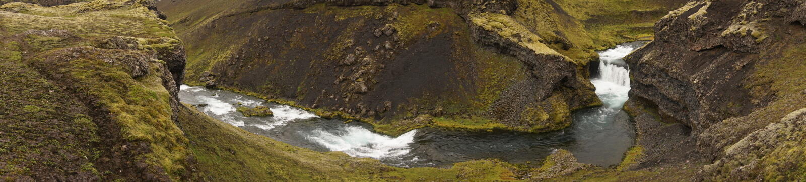
Right before the first ascend, we found a small but beautiful waterfall. Because we wore our clothes for a few days now, we decided to take a break and wash ourselves and our clothes.
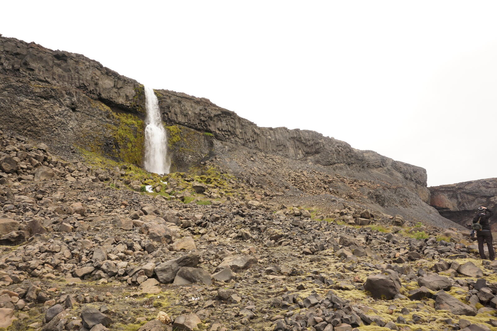
There were even more waterfalls further along the cliff, but this one was the nearest and most beautiful one. The water was unbelievably cold, nevertheless, it was a good feeling to be clean and put on a fresh shirt and socks.
We tied our wet clothes onto our backpacks, hoping they might dry a bit. Unfortunately, it just started to rain slightly.
The ascend
The ascend was – as expected – very steep, especially the backpacks felt really heavy and caused us problems. Not helping either was the uneven and soft ground, consisting mainly of loose scree with some larger rocks in it. During the sometimes over 45° steep ascend, we focused on not climbing directly behind each other. It happened not rarely that a larger rock rolled down the hill and took further stones with it. When the stones became larger and the way more impassible, Kristina twisted her ankle quite badly so that we had to take a break.
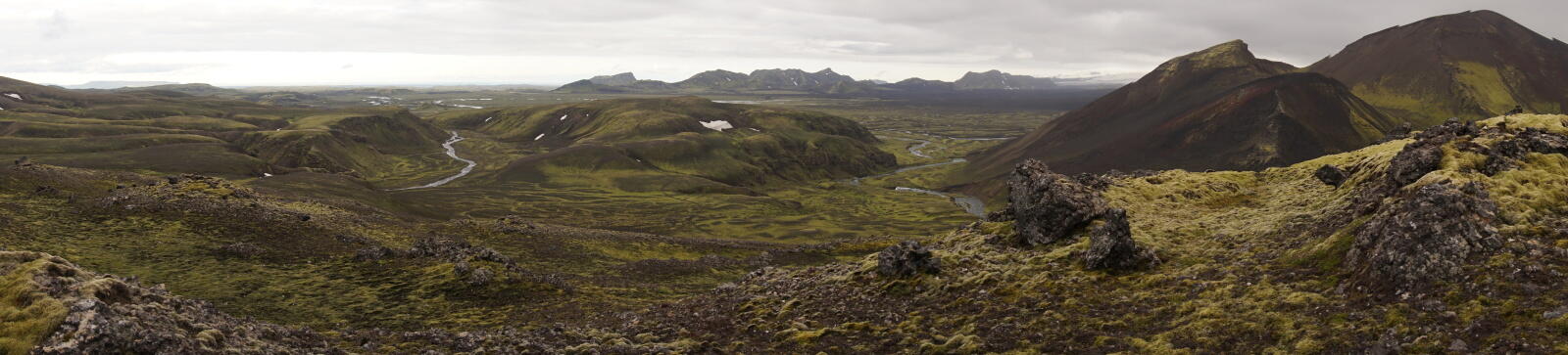
After reaching the top, we had a beautiful view over the valley we came from, including the glacier. Looking forward, we only saw nothing but flat and endless land.
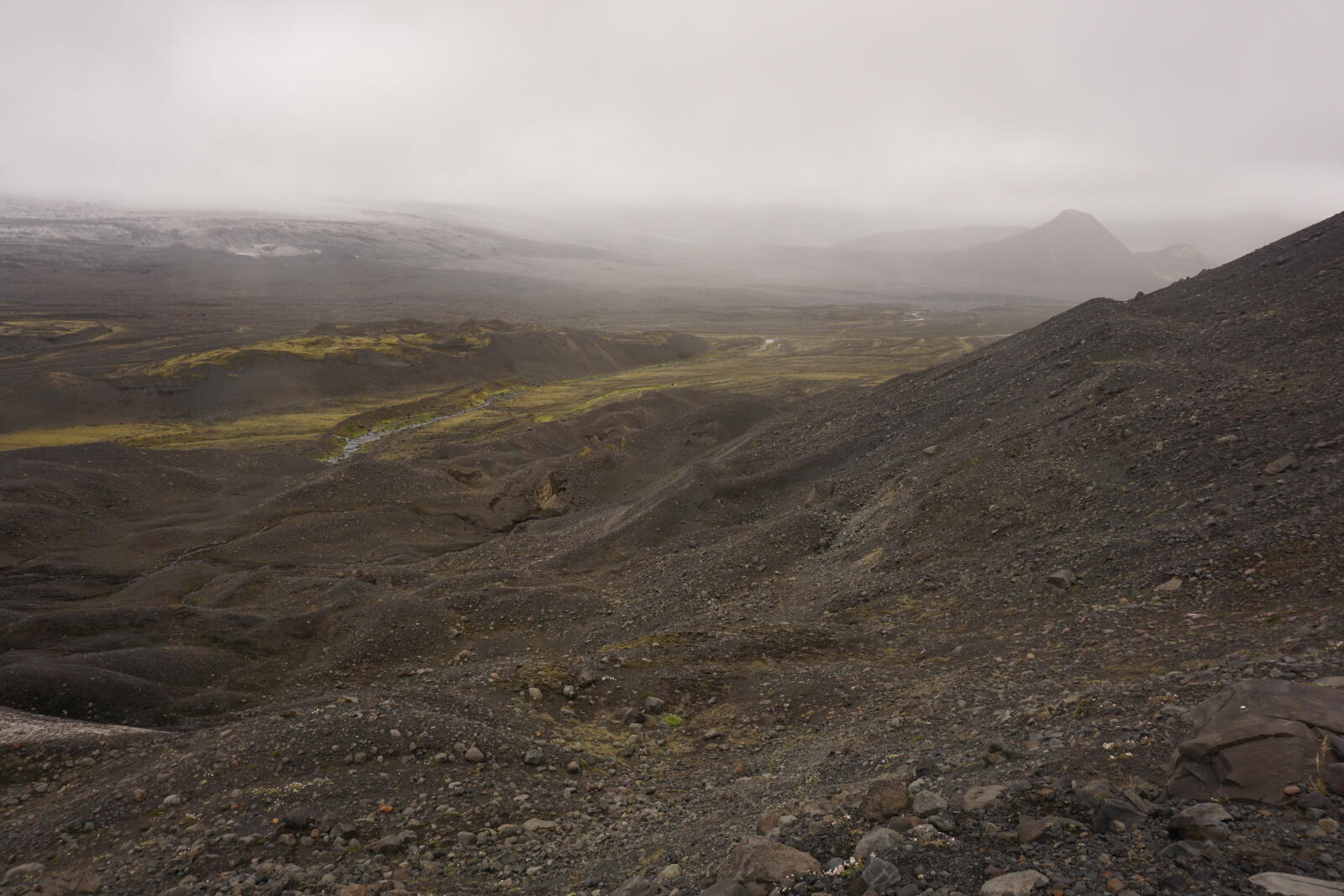
The weather wasn’t that bad (light rain and some wind), but upcoming fog became increasingly dense …
Fog and emergency camp
After some while, we weren’t able to see anything through the fog anymore. It’s also possible that we were inside some low-hanging clouds, the transition was smooth. Nevertheless, we soon lost all of our orientation.
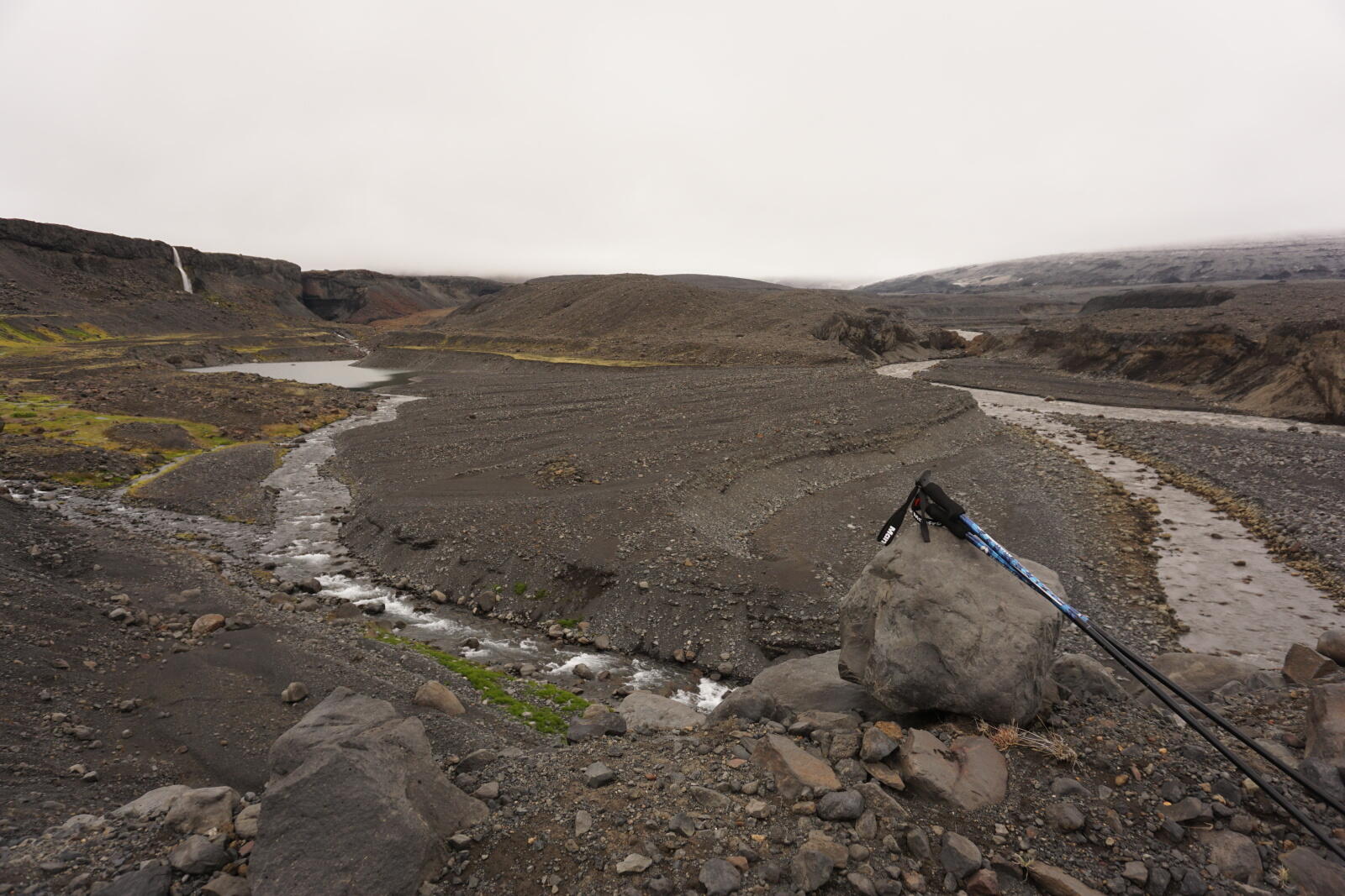
Due to our map, we knew that a larger river was somewhere near us. We decided to find and ford that river and camp on the other side but unfortunately we haven’t found that river. After a while of searching, we built up our tent behind a larger rock, which gave us some wind protection. The ground there was not so stony but more sandy.
Day 5: Innri-Emstruá → Mælifell
Jul 22, 2018
We set up a “peeky-timer” for 6 a.m. to see if the fog is still there. Unfortunately, it was as foggy as the day before, so we slept until 8 a.m. While collecting all our stuff and taking down the tent, the fog was nearly gone. After walking a few meters, we immediately saw the river we searched the day before. It was about 50 meters next to our tent. So we sight was really not that good ;)
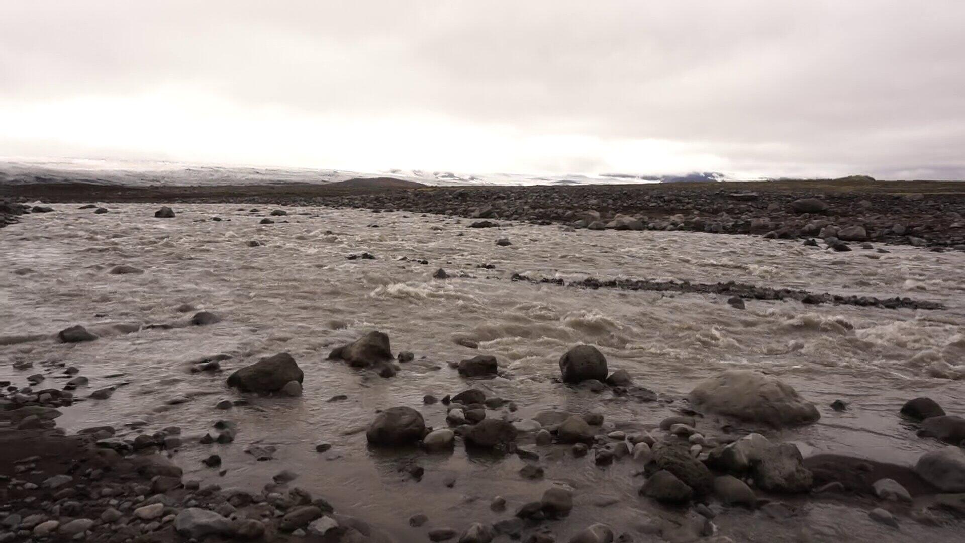
The a**hole river
The next big river we approached was the Innri-Emstruá. Until now, it was the largest, fastest and deepest river we had to ford. When we went there (end of July) the river was about 20 m / 65 ft wide. Because we forded diagonally, the actual distance was about 25 m / 80 ft.
The water was very turbid (fed by the nearby glacier), so we couldn’t see how deep it was. Therefore we completely took off our pants, just to be safe. After storing all electronic devices, clothes and other equipment in plastic bags and loosening our belts, we started fording.
When we started fording, the water was about 80 cm / 2.7 ft deep, so our underpants got wet. For me, the water reached my crotch, for Kristina it reached hear hip. The forces affecting was were huge and we were only able to walk really slowly.
In addition to the sight, the water was very fast carrying away our trekking poles after sticking them into the water. We tried to place them way above our position to they touched the ground next to us. However, the ground was full of large rocks, making it impossible to find a stable stand – neither with the poles nor with the feet.
Rocks in the water:
The water directly in front as well as behind a rock is deeper.
Additionally, the water in front of a rock is dammed a bit.
Behind a rock, the water is a bit calmer, at the sides, however, even faster.
I found it the easiest way to go behind rocks with some distance to them.
Luckily we made it relatively dry to the other side, but it was quite adventurous and not easy. Next to the fast flow, deepness and bad sight, the water was extremely cold. Young glacier rivers have a temperature of about 2-3 °C (35-37 °F), so be prepared for a lot of pain when staying in there for more than one/two minutes.
Tor the distance of about 25 m / 80 ft, it took us about 15-20 minutes to completely cross the river.
Alternatives
We had two alternatives to not cross the Innri-Emstruá: A bridge of the F261 in the north and the glacier in the south.
Using the bridge would have caused a 15 km / 9.5 mi detour (for us, more than a whole day of hiking), which was actually a problem. The glacier was the other possible choice, but this wasn’t safe at all due to the lack of experience with glacier hiking.
We wrote about the search for alternatives in our article about the planning of our trip. If crossing the Innri-Emstruá had not worked out for us, we had at least two possible alternatives.
Danger of frostbite and nerve damage
There are four grades of frostbite (medical term: congelation). Wikipedia says:
- grade (congelatio erythematosa): numb and pale skin, swelling of the skin, pain
- grade (congelatio bullosa): red or blue-red skin color, swelling and blisters
- grade (congelatio gangraenosa): (nearly) dead tissue
- grade: completely destroyed and/or frozen tissue
We could see the missing blood circulation in our legs after fording the river: They were nearly white and stayed so for an hour or another. After this river, I also had numb feeling toes for half a year.
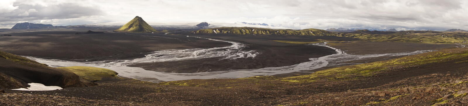
Endless expanse on the Mælifellsandur
After the Innri-Emstruá the trip was quite relaxing and also the weather became better. After a short ascent, we reached a lake near the bottom of the Sléttjökull.
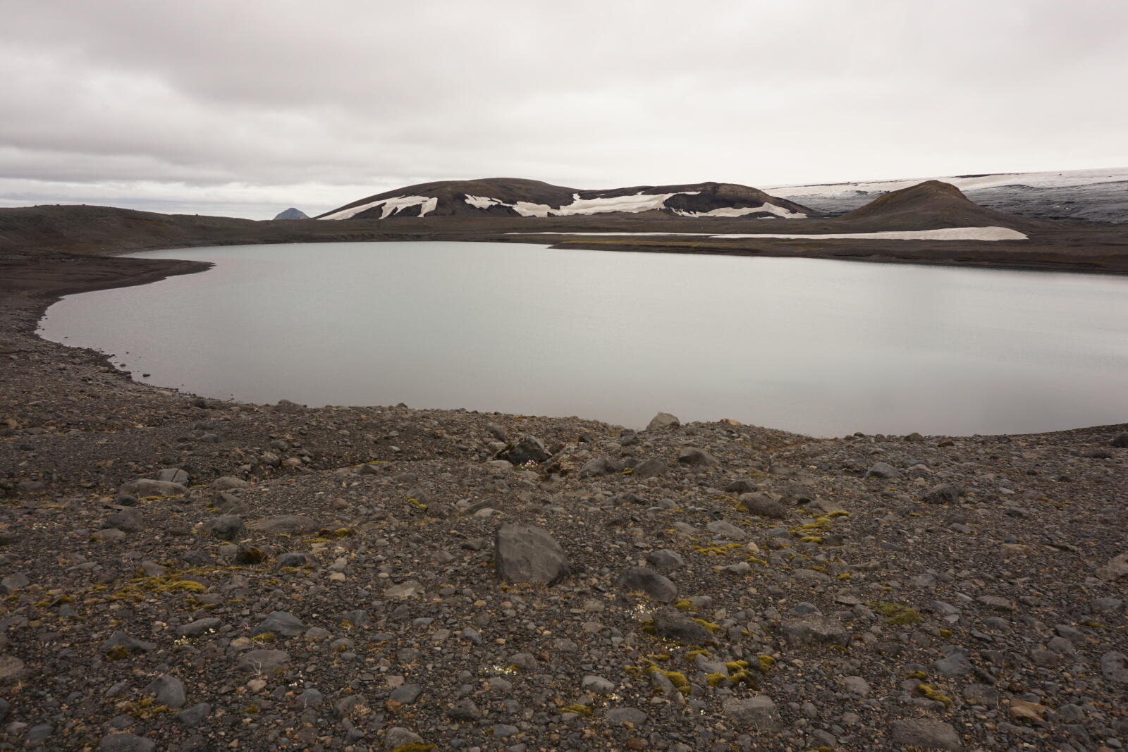
We relaxed a bit at the lake, filled up our water bottles and continued via the Mælifellsandur towards the Mælifell.
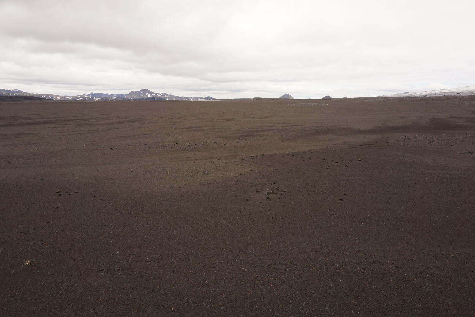
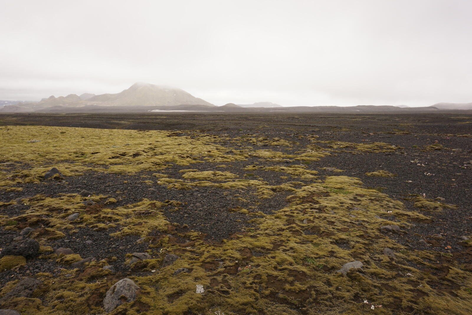
This plain was very flat and walking on it was mostly quite comfortable, so we were relatively fast. We had to cross some smaller streams, but that was possible without even taking off our shoes.
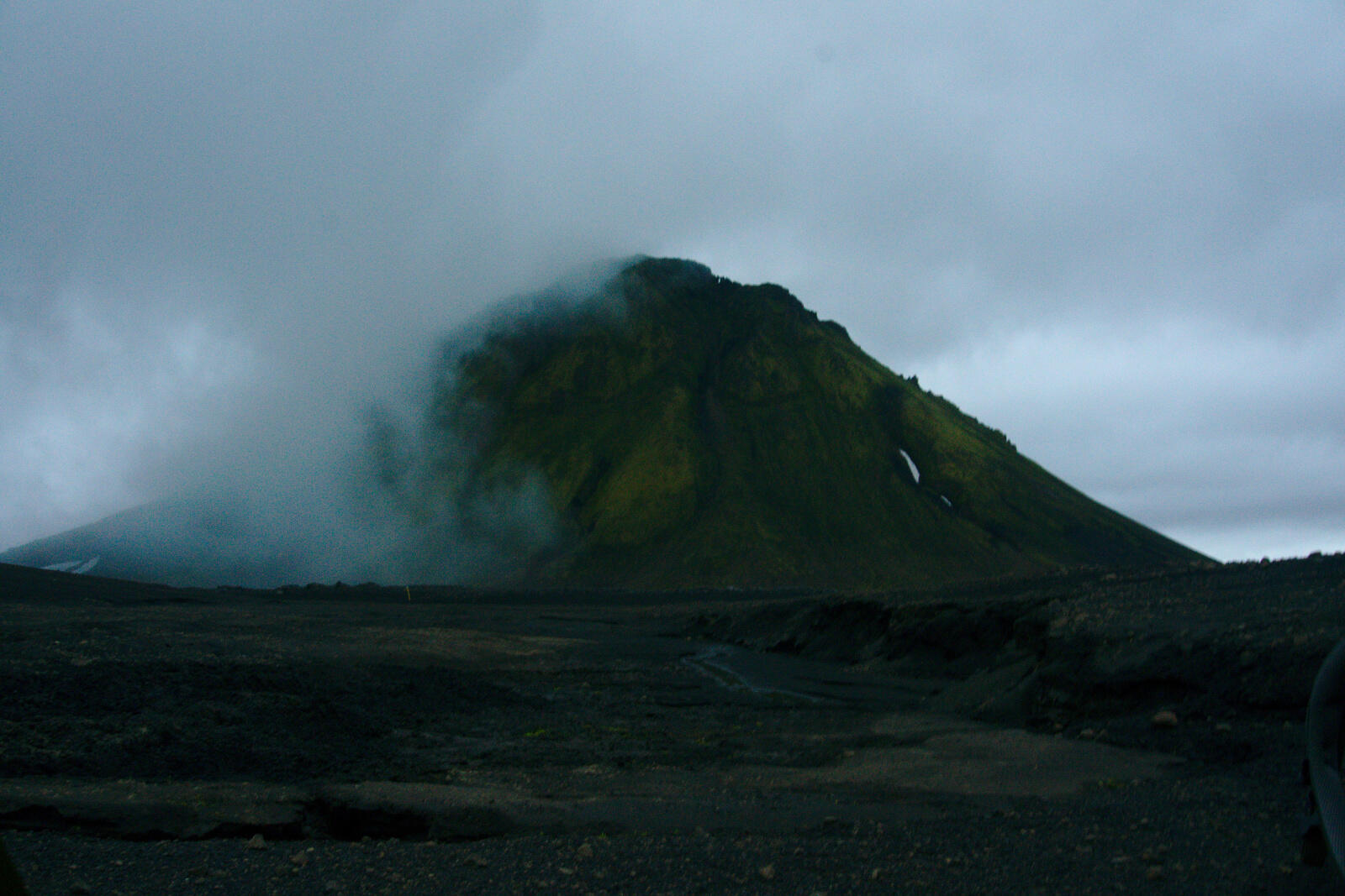
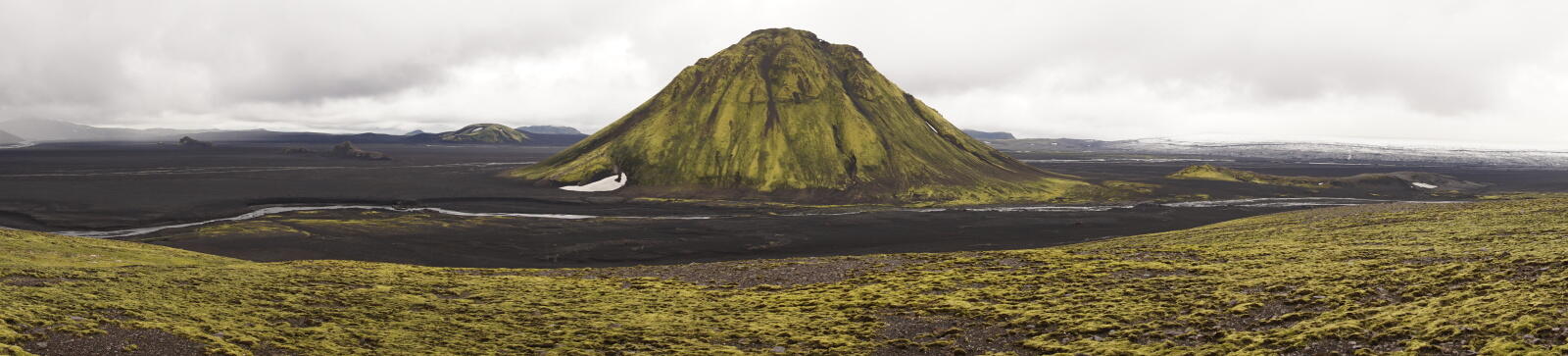
Right before the Mælifell, we reached the Brennivínskvísl river, a larger river we had to ford. After that, we finally arrived at the Mælifell after seven hours of volcanic plain.
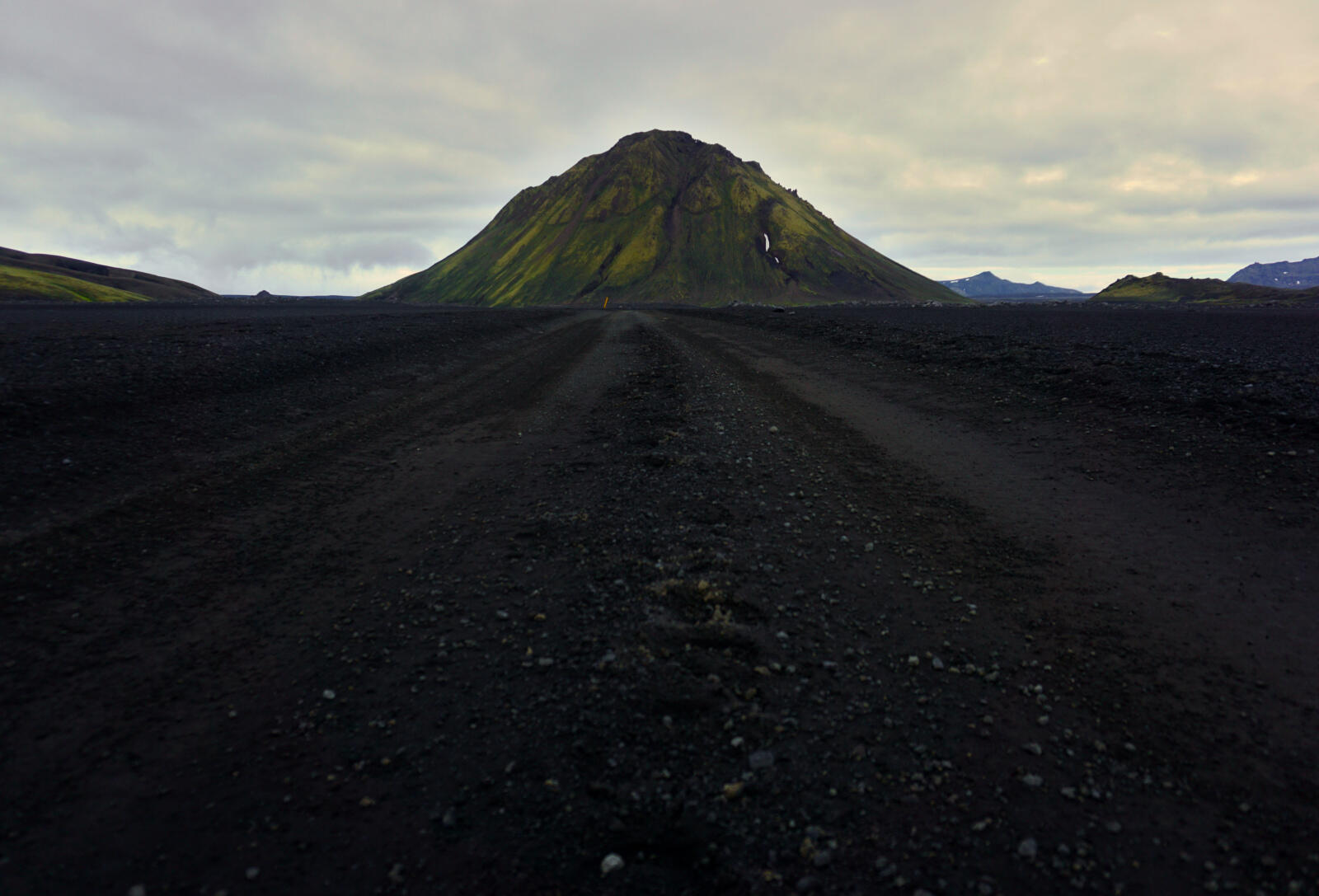
As it should be for photogenic highlights, thick and low-hanging clouds came up and cloaked the green mountain.
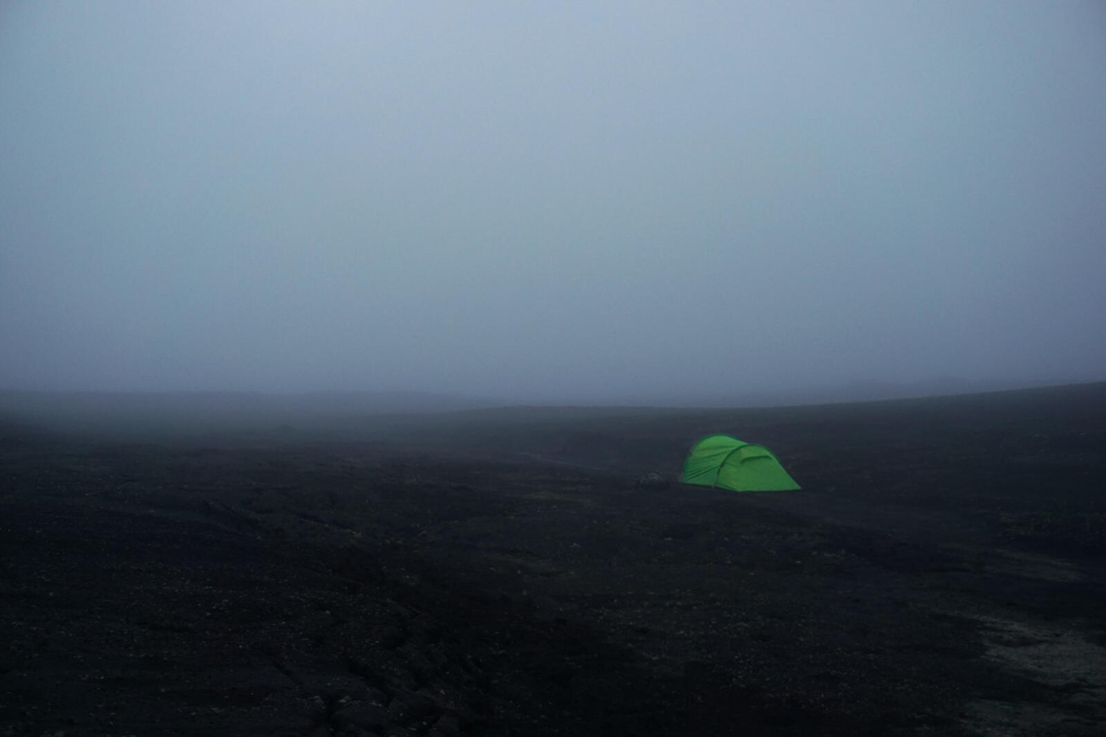
After a 16-hour hiking day, we directly fell asleep after lunch.
Day 6: Mælifell
Jul 23, 2018
We stayed at the Mælifell for a day to get some rest. This day was planned in our timetable, so we didn’t fell behind.
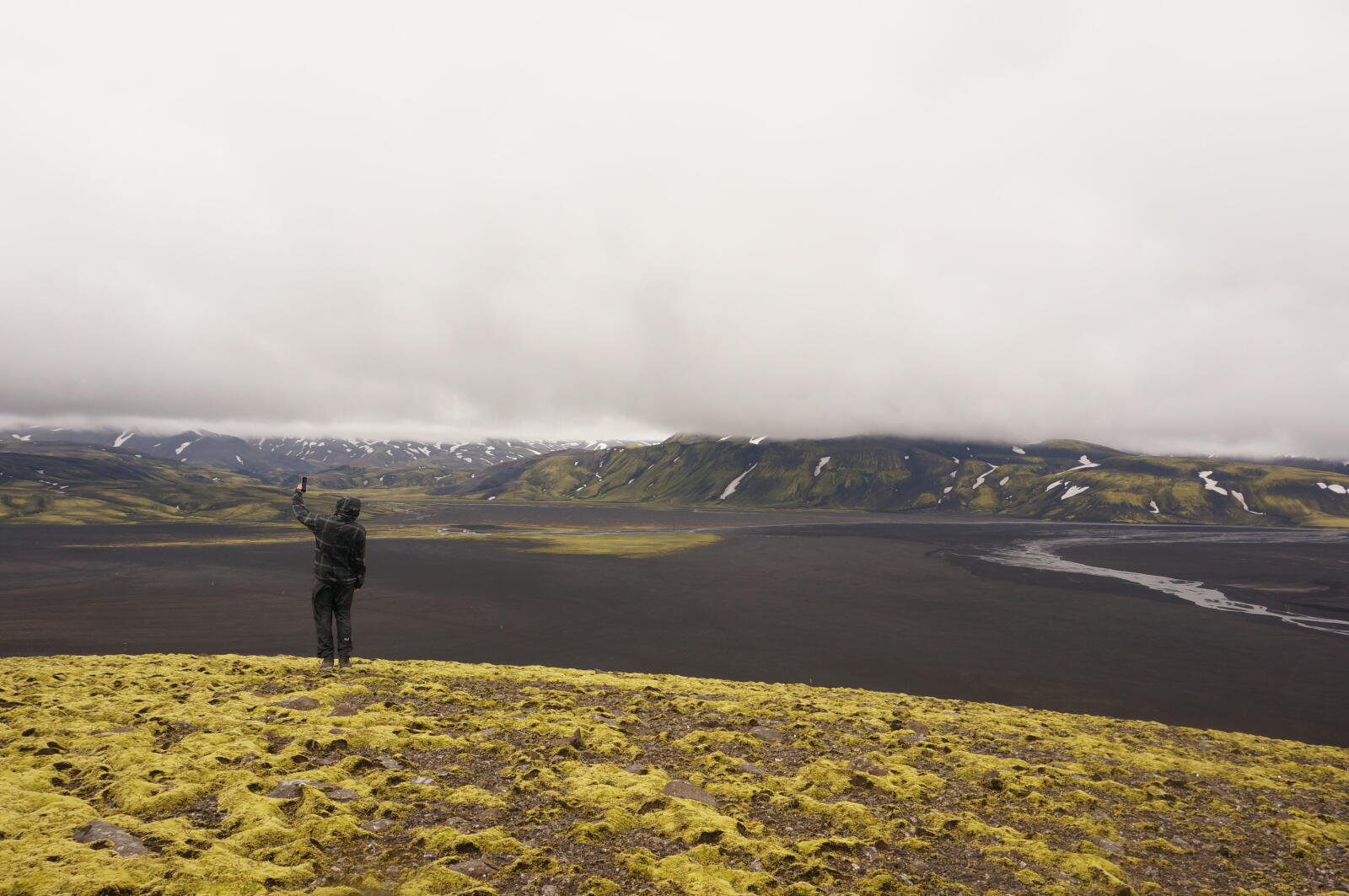
After sleeping quite long, we climbed up a nearby hill and had a fantastic view over the whole landscape.
We were told that the mobile reception is better when staying on a hill. This was true except – due to Murphy’s law – for the moment you want to send an SMS or call somebody.
Day 7: Mælifell → Hólmsárlón
Jul 24, 2018
Today we continued to the lake Hólmsárlón.
River delta and waterfall
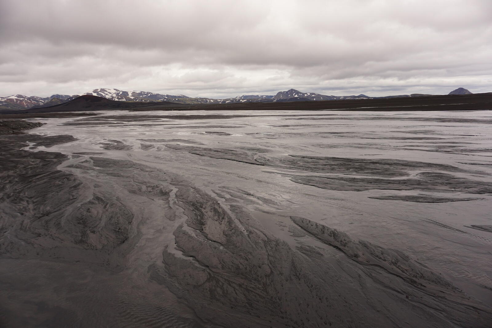
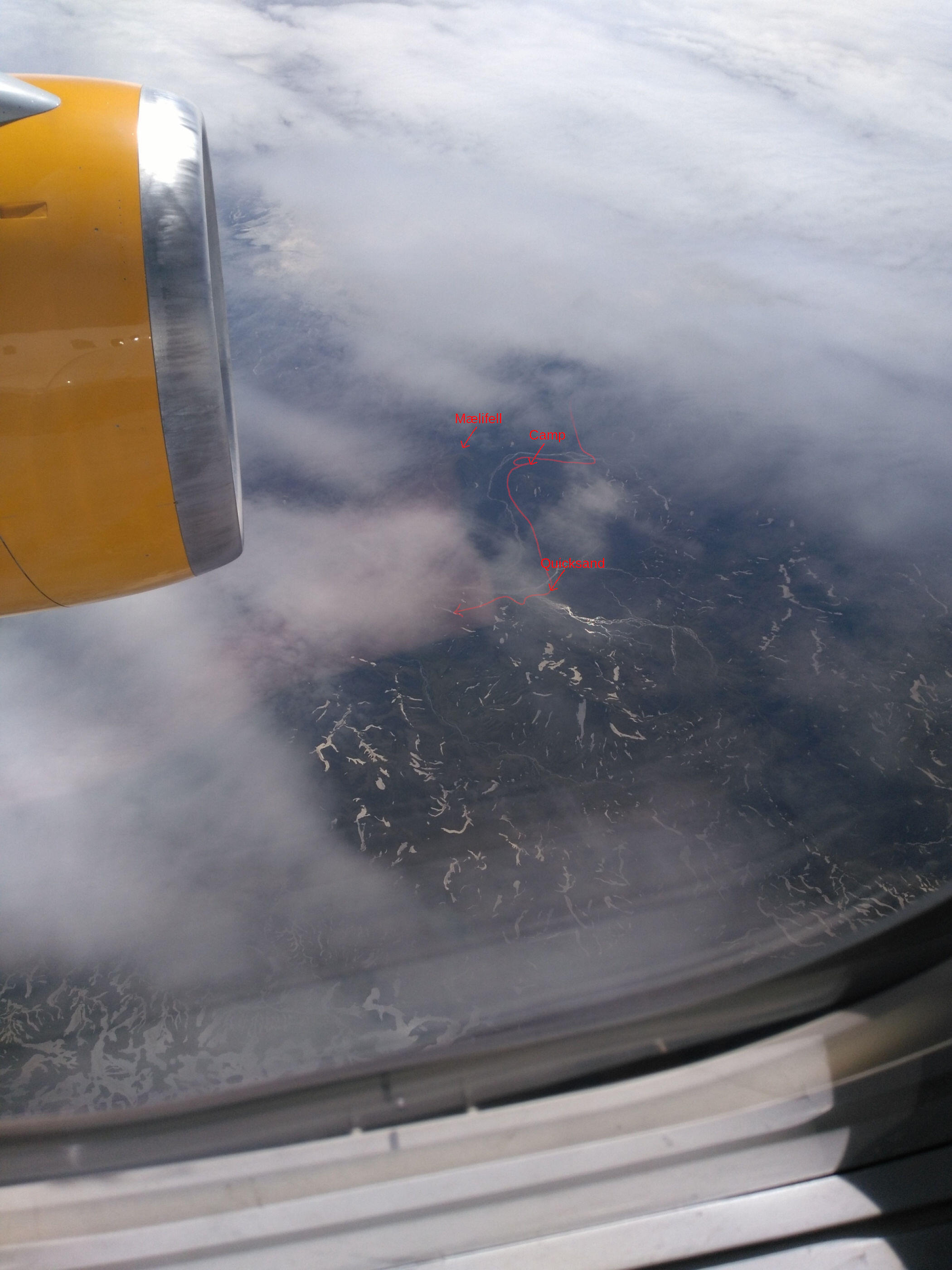
First, we went along the Brennivínskvísl towards the Strútur, where we had to cross a large river delta we already saw from the airplane. The rivers were not that deep, fast or difficult, however, the ground was even more difficult. There was a lot of quicksand we sometimes sunk in up to our knees.
Because the Brennivínskvísl flows directly next to some hills and the river bank is quite steep, we just went over these hills. The rest of the trip was very beautiful and easy. After some time, we arrived at a cascade of waterfalls which were not marked on our map.
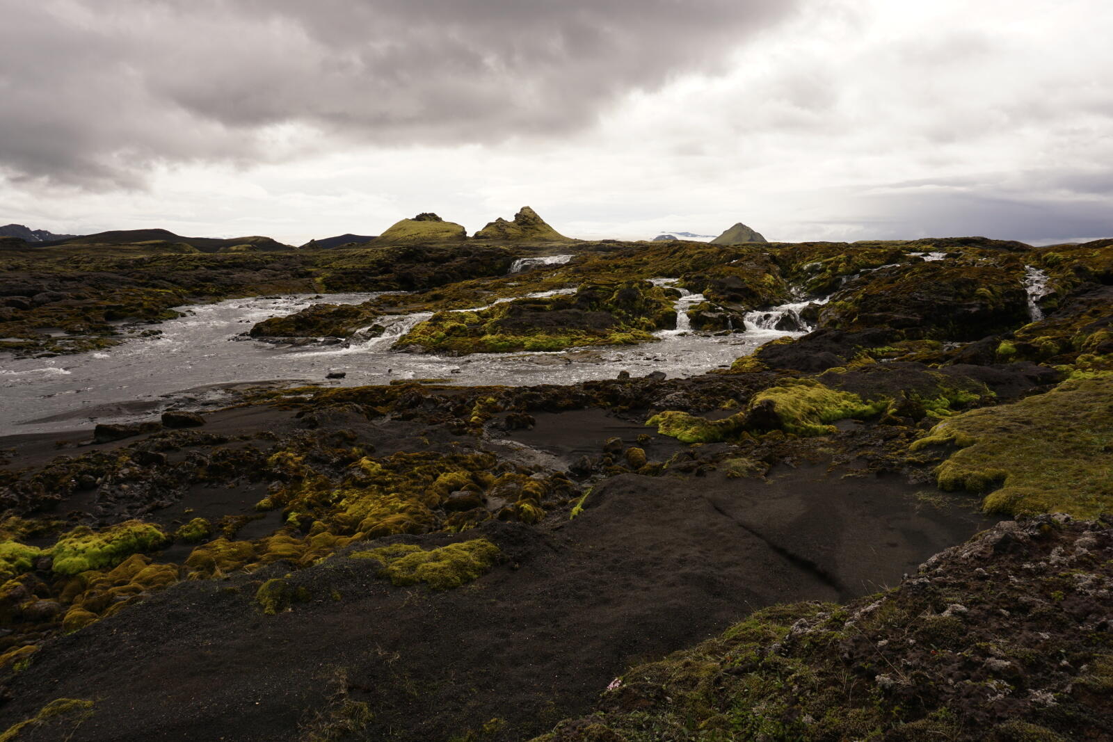
From there, the landscape became more green and there was even grass growing next to the moss. Finally, we crossed the river Hólmsá which was quite cold but not that difficult. Further upstream, the Hólmsá flowed through a canyon with further waterfalls.
Red crater
After hiking alongside the canyon for a while, we arrived at an old volcanic crater, which was very beautiful with a mixture of red, green and turquoise colors.

In the small crater lake, many rather shy birds were swimming around (probably ducks).
For the further route, we had two options: Crossing the river coming out of the lake or climbing up to the top of the crater edge. Because we didn’t want to ford another river, we decided to go up to the edge and walk around the crater. A decision we didn’t regret.
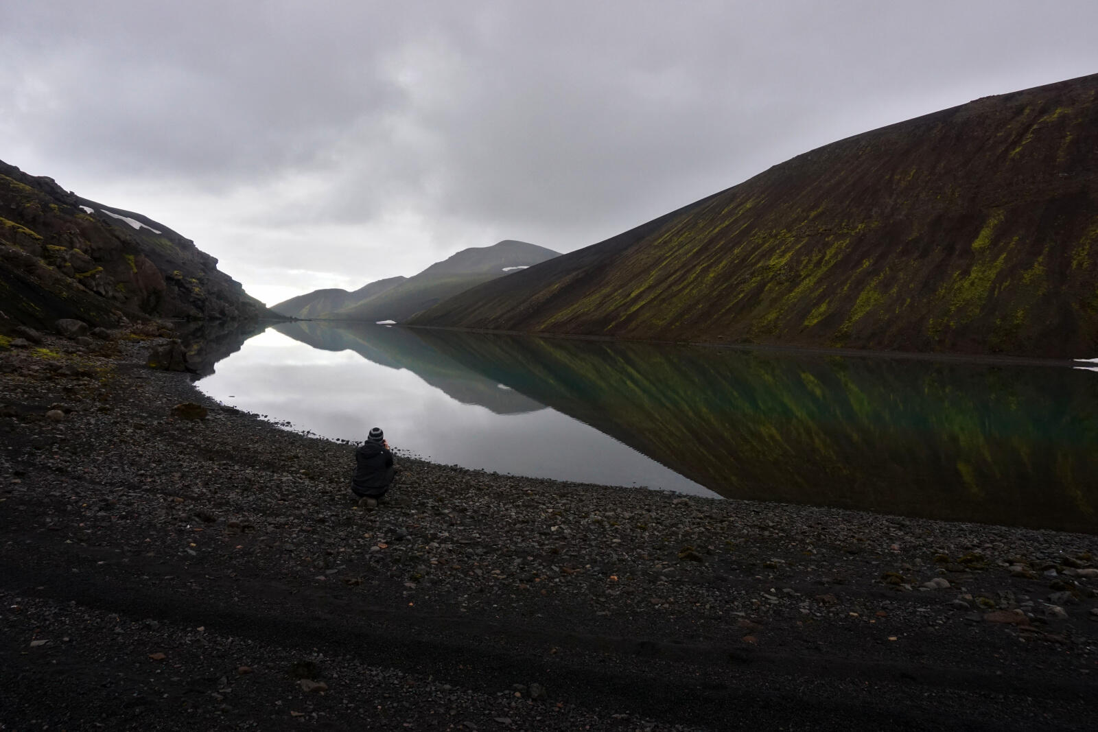
Further on the top, we followed some sheep paths leading to the lake Hólmsárlón.
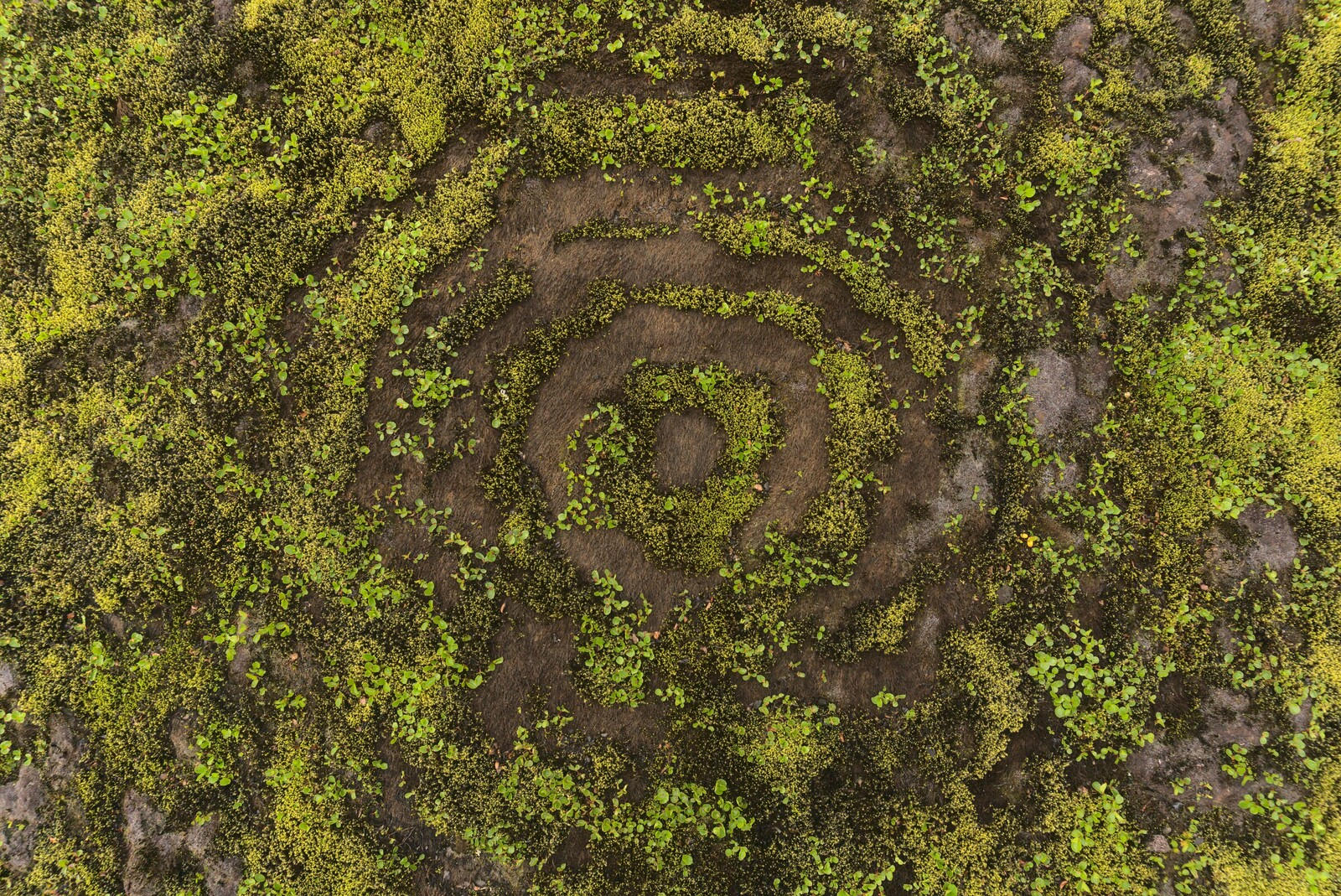
All over Iceland, you’ll find these strange-looking circles in the moss called Nornabaugar (witch’s rings). They result from a mushroom growing in the moss, but that mushroom also kills it. The seasons and the moss’ grow-cycle create these circles.
Camp on the lakeside
The slopes at the lake were very steep and we used the valley of a smaller stream to go down to the shore. Even though the stream was less steep, it was very slippery.
As we learned later, many fishes were set free in the Hólmsárlón lake which bred very fast. Due to the lack of predators, the population grew uncontrolled, and they all died due to the resulting lack of food. Therefore there are no fish anymore in the Hólmsárlón lake.
We camped directly at the shore and washed ourselves and our clothes. Clearly, the water was way too old to swim.
Next report (part 3)
I hope you liked this report and the photos.